Waugul track marker - a rainbow serpent


2003-2005 The Bibbulmun Track


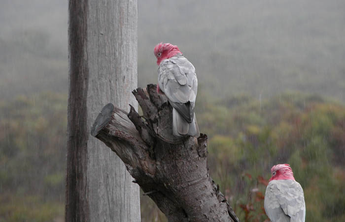
The Bibbulmun Track is described as being "one of the world's great long distance walk trails, stretching 600 miles from Kalamunda, near Perth, to Albany through the heart of the scenic south west of Western Australia. Along the way 48 state-of-the-art campsites provide facilities unmatched in the southern hemisphere. The track is very accessible, allowing for short family walks, today walks to overnights, to going end to end.

The Track was named to recognize the pre-European inhabitants of the area, the Bibbulmun. This was adopted as both unique and appropriate, even though the Track did not follow Aboriginal travel routes - rather it recognized the Bibbulmun people's practice of walking long distances for ceremonial gatherings.

  • Our start point at Williams Bay, the first of the many excellent trail markers along the way Our start point at Williams Bay, the first of the many excellent trail markers along the way
  • Peter descending the Track down to Madfish Bay Peter descending the Track down to Madfish Bay
  • Seabird activity on the southern shore of Wilson Inlet Seabird activity on the southern shore of Wilson Inlet
  • Mal ratting in his pack, crouched in his corner of the shelter situated on the Nullaki Peninsula Mal ratting in his pack, crouched in his corner of the shelter situated on the Nullaki Peninsula
  • Mal resting on a handy seat with West Cape Howe behind Mal resting on a handy seat with West Cape Howe behind
  • Peter, with West Cape Howe behind. The most southerly point on the Western Australian mainland Peter, with West Cape Howe behind. The most southerly point on the Western Australian mainland
  • The rugged southern coastline on a calm sea day ... a low ocean swell running in from the Antarctic The rugged southern coastline on a calm sea day ... a low ocean swell running in from the Antarctic
  • Mal setting up for the night in the shelter at West Cape Howe Mal setting up for the night in the shelter at West Cape Howe
  • Evening over the Albany Windmill Farm, as seen from the Torbay shelter Evening over the Albany Windmill Farm, as seen from the Torbay shelter
  • Mal hiking the five mile beach section, east of Torbay Mal hiking the five mile beach section, east of Torbay
  • Looking east from near Hidden Valley to the Windmill Farm Looking east from near Hidden Valley to the Windmill Farm
  • Spectacular surf below Hidden Valley with an offshore wind prevailing Spectacular surf below Hidden Valley with an offshore wind prevailing
  • Looking northeast from near Hidden Valley to the city of Albany Looking northeast from near Hidden Valley to the city of Albany
  • he last light of day beneath the Albany Windmill Farm, that produces 75 percent of that city's electric power he last light of day beneath the Albany Windmill Farm, that produces 75 percent of that city's electric power
{image.index} / {image.total}

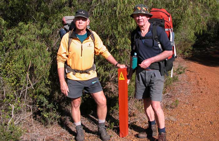
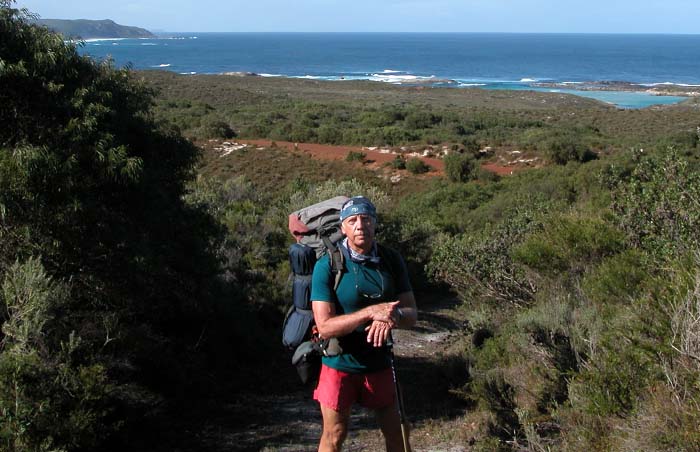
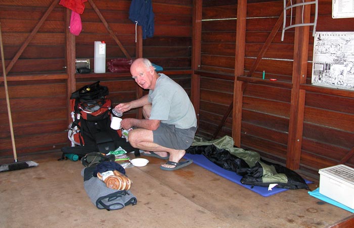
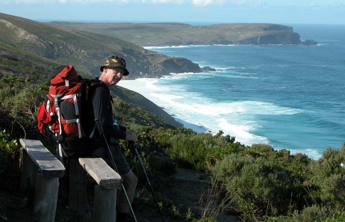
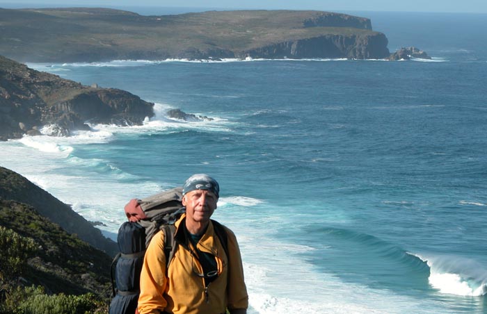
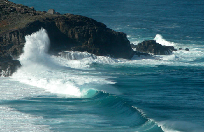
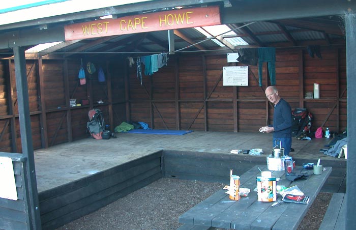
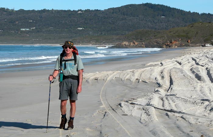
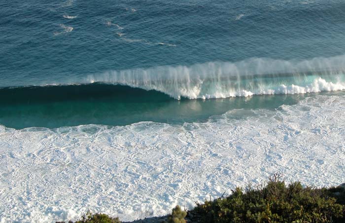
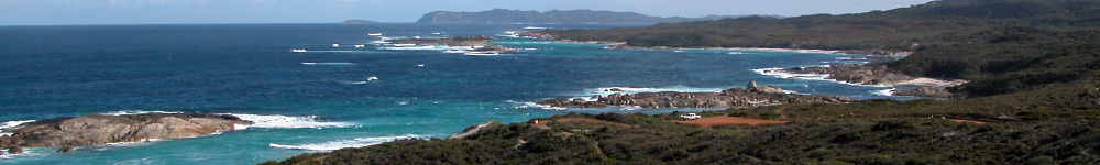
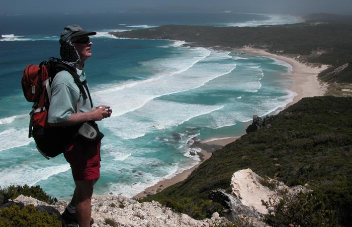
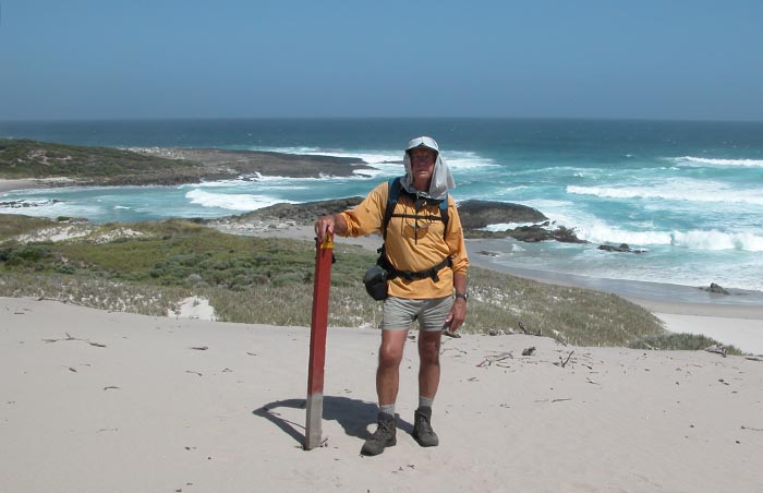
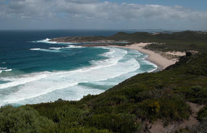
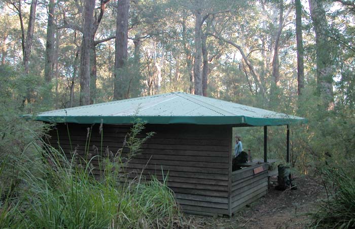
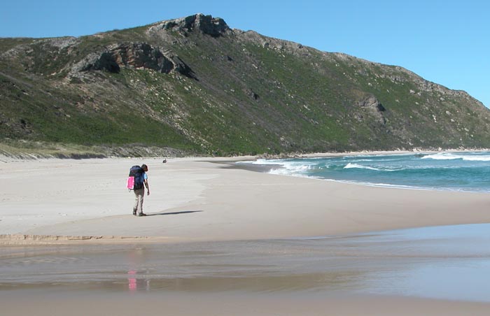
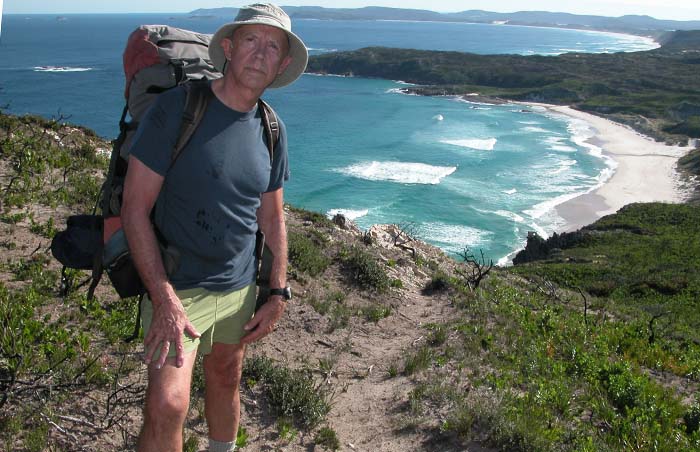
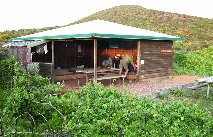
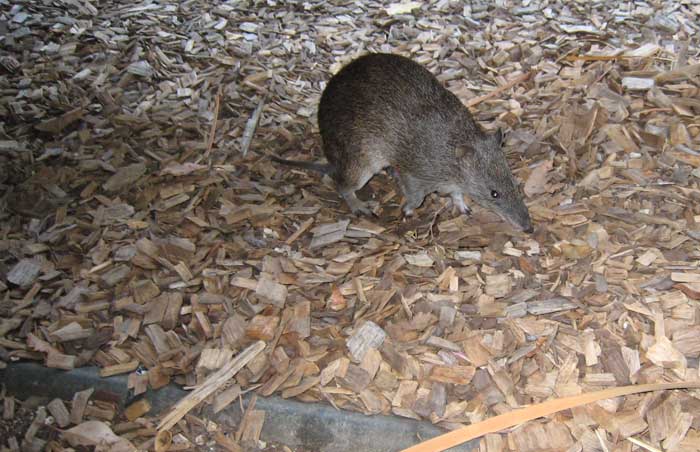
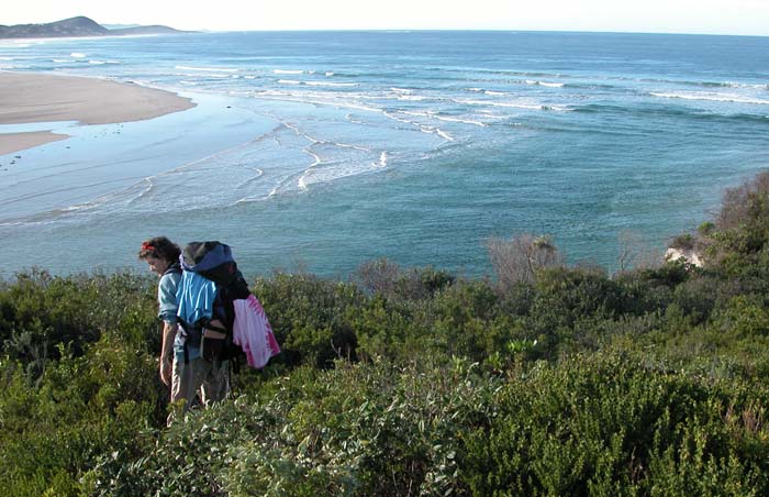
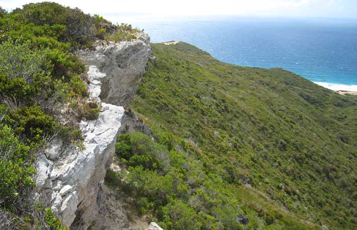
On the 23rd of May, 2003, Mal Hill and I began hiking a 60 mile section of the Track from Williams Bay to Albany, a section that runs along the spectacular southern coast of West Australia, rarely more than 500 yards from the pounding surf. We'd planned for six days on the Track, with five overnights in the well appointed shelters placed approximately 10 miles apart. As with most hiking in Australia, drinking water is not easy to find, requiring good planning for daily rations. Fortunately, on the Bibbulmun, each shelter provides an adequate supply of tanked rainwater.

We found the trail easy to follow and not particularly strenuous, despite the sandy conditions throughout this coastal stretch. There is however, a five mile section between Torbay and Shelter Island that's exclusively beach walking, very hard on legs and ankles, plodding in soft sand with a heavy pack. The shelters are more than adequate, but the wooden floors made the nights tough on aging bodies. The brilliant sunrises, a common feature of the southern coast, were particularly welcome each morning ... time to get up and start moving again! The weather remained fine for the five days we eventually spent on the Track. We made an extra effort on the fifth day so as to bypass the shelter at Hidden Valley, the last stop before Albany.

  • Mal on the Conspicuous Cliffs, after a difficult climb from the beach below. Looking west to Walpole Mal on the Conspicuous Cliffs, after a difficult climb from the beach below. Looking west to Walpole
  • Peter on the beach below  the high bluffs east of Conspicuous Cliffs and west of Peaceful Bay Peter on the beach below the high bluffs east of Conspicuous Cliffs and west of Peaceful Bay
  • Boat Harbour seen from the bluffs to the east. Roof of the shelter can be seen below the saddle. Boat Harbour seen from the bluffs to the east. Roof of the shelter can be seen below the saddle.
  • Looking west from the high bluffs between Boat Harbour (beyond the main beach) and Parry Head Looking west from the high bluffs between Boat Harbour (beyond the main beach) and Parry Head
  • Looking east along the high bluffs between Boat Harbour and Parry Head Looking east along the high bluffs between Boat Harbour and Parry Head
  • The rough coastline below the high bluffs between Boat Harbour and Parry Head The rough coastline below the high bluffs between Boat Harbour and Parry Head
  • Mal searching out the safest crossing of Irwin Inlet on the long beach between Boat Harbour and Peaceful Bay Mal searching out the safest crossing of Irwin Inlet on the long beach between Boat Harbour and Peaceful Bay
  • Green's Pool in the William Bay National Park and the boundary between our Bibbulmun walk in 2003 and 2004 Green's Pool in the William Bay National Park and the boundary between our Bibbulmun walk in 2003 and 2004
  • The sheltered pools behind the rocks in William Bay National Park. Parry Head in the distance The sheltered pools behind the rocks in William Bay National Park. Parry Head in the distance
  • A pair of Galahs enjoying a rare rain shower along the coast A pair of Galahs enjoying a rare rain shower along the coast
{image.index} / {image.total}

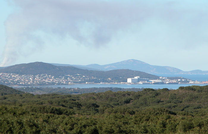
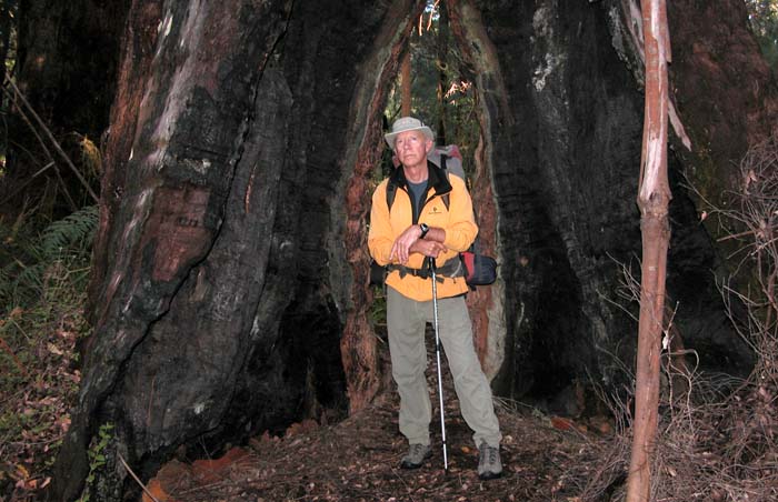
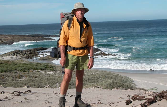
In the Australian summer of 2004, Mal Hill returned to our house in Albany for a two week visit, having driven from Brisbane with his wife Merle. Among other things, we tasted and quaffed a variety of the local wines, but also decided to complete the southern coastal sections of the Bibbulmun Track that we'd missed the previous year.

In 2003 we'd hiked from the Green's Pool area of the William Bay National Park, east along the coast to Albany, a distance of 50 miles. A further section of 40 miles runs west along the coast to Conspicuous Cliffs before swinging inland toward the Valley of the Giants, a heavily forested area of huge Tingle and Karri trees. This 40 mile section was our goal for 2004. We elected to cover the distance by day hiking with the use of two cars and nights spent in established campgrounds ... close to food and wine!

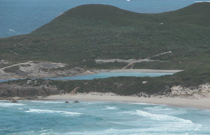
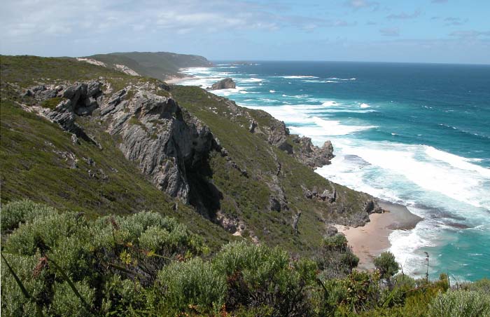
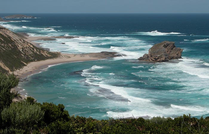
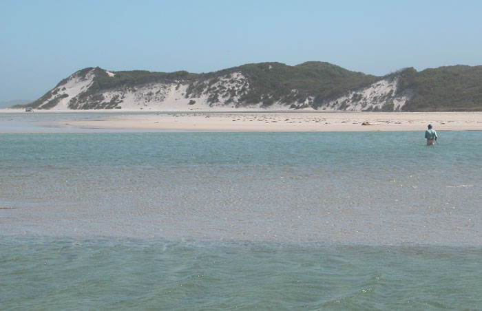
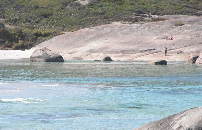
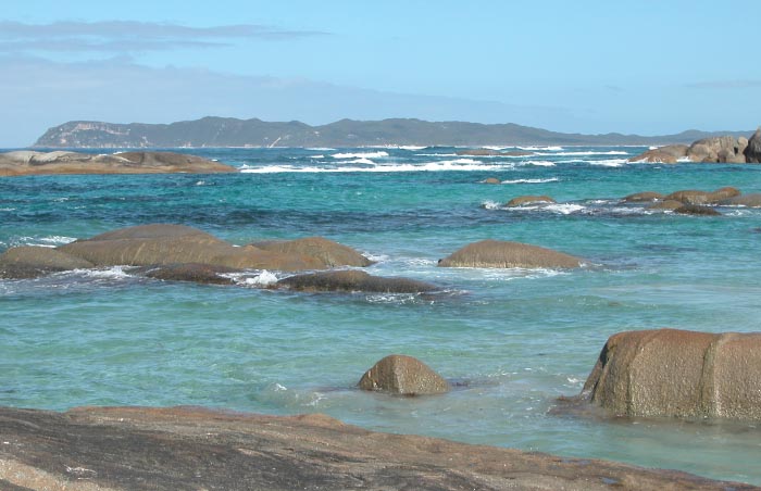
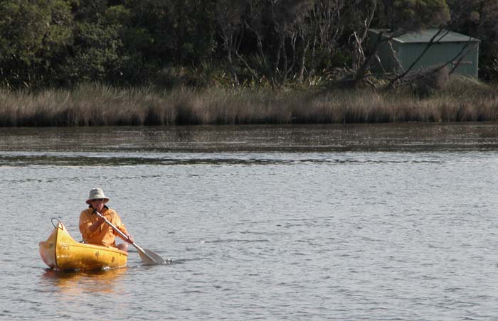
Our first foray was from the Peaceful Bay campground. Leaving a car and tent there, we drove the second vehicle to Conspicuous Cliffs and hiked east along the beaches and bluffs to Peaceful Bay. The next day wasn't so straightforward, or easy, with the plan to hike west from Boat Harbour to Peaceful Bay. For starters, we bogged one car in sand on the four-wheel drive road to Boat Harbour, resulting in an additional 4 mile hike to intercept the Bibbulmun Track. Then, having elected to walk the beach and cross Irwin Inlet near the surf, our rather desperate passage was made chin deep in a strong tidal flow and with packs on head. The remaining section from Boat Harbour east to William Bay was day hiked from Parry Head, out and back in both directions.

In 2005, Lucy and I hiked the complete southern coastal section from the Valley of the Giants to Denmark. We positioned a car near Wilson Inlet and drove to the Tree Top Walk to park a second car. Stayed the first night at the Giants shelter, the second at Rame Head, the third in the campground at Peaceful Bay, the fourth at Boat Harbour and the fifth at Williams Bay. In early 2008, I hiked the section from Wilson Inlet to Sandpatch as a final adventure before leaving Australia and returning to the USA for good.

©2008Peter Tremayne, Reno, Nevada USA

  • The Giants shelter near the Tree Top Walk in the Valley of the Giants The Giants shelter near the Tree Top Walk in the Valley of the Giants
  • Peter southbound from the Giants shelter to Conspicuous Beach Peter southbound from the Giants shelter to Conspicuous Beach
  • Lucy walking Conspicuous Beach with the Cliffs behind Lucy walking Conspicuous Beach with the Cliffs behind
  • Peter on the high point of the Conspicuous Cliffs Peter on the high point of the Conspicuous Cliffs
  • The shelter at Rame Head.  Lucy and fellow hiker setting up for the night The shelter at Rame Head. Lucy and fellow hiker setting up for the night
  • Peter on the beach to the west of Peaceful Bay Peter on the beach to the west of Peaceful Bay
  • A pair of "28s" parrots on the ground near Peaceful Bay A pair of "28s" parrots on the ground near Peaceful Bay
  • A Bandicoot or a near cousin (?) near Peaceful Bay A Bandicoot or a near cousin (?) near Peaceful Bay
  • Lucy on the Track above Irwin Inlet and it's seasonal sandbar.  We need the canoes to cross! Lucy on the Track above Irwin Inlet and it's seasonal sandbar. We need the canoes to cross!
  • Peter crossing on a Track canoe from the western side of the inlet to the eastern shore Peter crossing on a Track canoe from the western side of the inlet to the eastern shore
  • The limestone outcrops above Shelley Beach The limestone outcrops above Shelley Beach
{image.index} / {image.total}