A Ten Year Effort to Climb Mount Sill


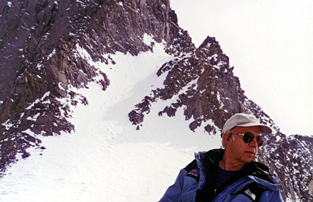
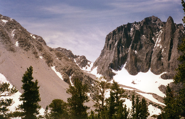
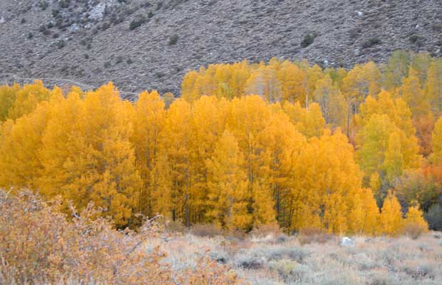
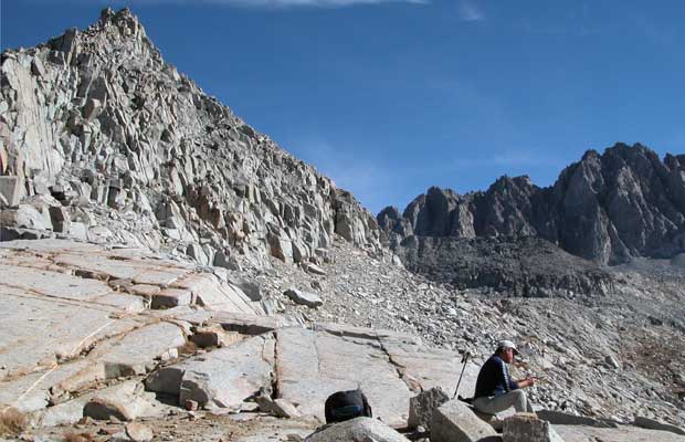
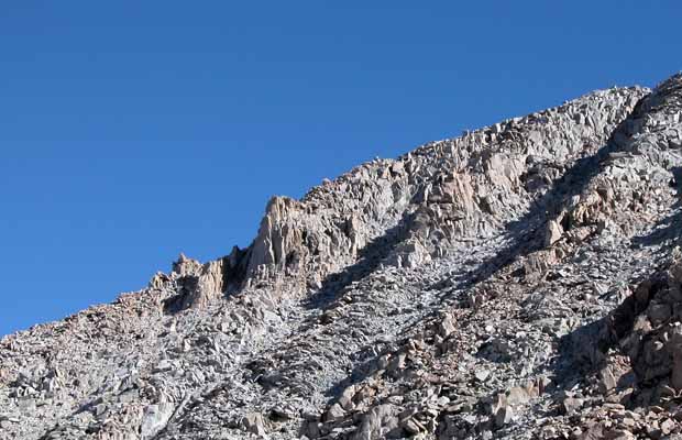
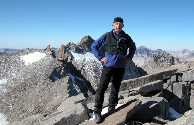
On October 19, 2002, I finally stood on the summit of Mount Sill at an elevation of 14,153 feet; a moment I'd anticipated and strived for since 1992. Ten years of my life searching for fulfillment of a dream that most would consider pointless. But this mountain had become my Everest -a climbing challenge that had frustrated me since I first stood beneath the peak's vertical East Face, wondering how I could ever expect to climb this mountain alone.

The guide book for the Palisade range indicates that the only "easy" route on the mountain leads up the southwestern slope. The problem is getting to that side of the range. It's a long, difficult cross-country rock scramble from Dusy Basin and logistically demanding because of the days involved.

  • Oct. 1992: First attempt - hiking in on the Big Pine Creek North Fork trail Oct. 1992: First attempt - hiking in on the Big Pine Creek North Fork trail
  • Oct. 1992: Looking at the east face of Mt Sill from the southern side of Contact Pass Oct. 1992: Looking at the east face of Mt Sill from the southern side of Contact Pass
  • Apr. 1997: Lucy leading the climb to Glacier Notch from Palisade Glacier Apr. 1997: Lucy leading the climb to Glacier Notch from Palisade Glacier
  • Apr. 1997: Peter at Glacier Notch with Sill's North Couloir behind.  Swiss Arete on the left Apr. 1997: Peter at Glacier Notch with Sill's North Couloir behind. Swiss Arete on the left
  • Sep.1998:  Lucy made small on the Sill Glacier -- under the east face of Mt Sill Sep.1998: Lucy made small on the Sill Glacier -- under the east face of Mt Sill
  • Sep. 1998: Lucy climbing to Glacier Notch from the South Fork drainage Sep. 1998: Lucy climbing to Glacier Notch from the South Fork drainage
  • Sep 1998: Lucy climbing to Glacier Notch from the South Fork drainage Sep 1998: Lucy climbing to Glacier Notch from the South Fork drainage
  • September 1998: Lucy leading the climb on Sill's North Couloir September 1998: Lucy leading the climb on Sill's North Couloir
  • Sep. 1998: Lucy descending from Sill's North Couloir.  Swiss Arete behind. Sep. 1998: Lucy descending from Sill's North Couloir. Swiss Arete behind.
  • Temple Crag with Contact Pass in center -- as seen from Sam Mack Meadow Temple Crag with Contact Pass in center -- as seen from Sam Mack Meadow
  • Looking south from Palidade Glacier.  Mt. Sill on the left.  U & V Notches on right Looking south from Palidade Glacier. Mt. Sill on the left. U & V Notches on right
  • Looking south over Palisade Glacier.  This view is from the summit of Mt. Agassiz Looking south over Palisade Glacier. This view is from the summit of Mt. Agassiz
  • Looking north from Sill Glacier --Glacier Notch in center & Mt Gayley on right Looking north from Sill Glacier --Glacier Notch in center & Mt Gayley on right
  • Looking west from South Fork Trail.  Scimitar Pass on left -- Mount Sill on the right Looking west from South Fork Trail. Scimitar Pass on left -- Mount Sill on the right
  • Looking up at Scimitar Pass from Sill Glacier Looking up at Scimitar Pass from Sill Glacier
{image.index} / {image.total}

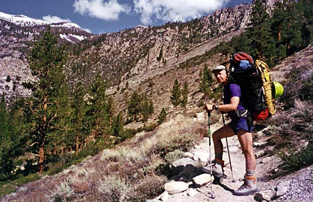
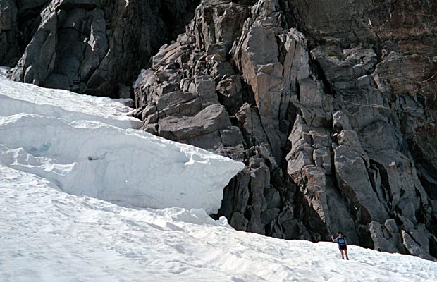
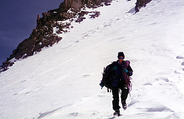
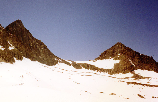
Alternatively, it's possible to cross the range more quickly by using a high elevation Pass like Scimitar, accessed from the South Fork of Big Pine Creek. However, this option somewhat defeats the object of reducing the level of risk. I know, because I tried this route in 1999 to avoid the hazards of the eastern face couloirs.

During September,1998, accompanied by my wife Lucy, we attempted to climb Mt Sill from either the Southeast or North Couloirs. In the event, we did reach within 400 feet of the summit using the North Couloir route, but that was a dangerous day-not to be repeated. So, having exhausted all reasonably safe options over the ten years of trying, the success this year was the result of taking the long route across Bishop, Knapsack and Potluck Passes to access the southwestern slope - and in the company of an experienced companion, Jim Slade.


  • Oct. 2002: Jim relaxing at the South Lake trailhead before heading out on our climb Oct. 2002: Jim relaxing at the South Lake trailhead before heading out on our climb
  • The colors of October in the Sierra Nevada on the road to Bishop's South Lake The colors of October in the Sierra Nevada on the road to Bishop's South Lake
  • Our first camp in Dusy Basin - Columbine Peak behind Our first camp in Dusy Basin - Columbine Peak behind
  • On the approach to Knapsack Pass from Dusy Basin On the approach to Knapsack Pass from Dusy Basin
  • Mt Agassiz at sunset as seen from our first camp in Dusy Basin Mt Agassiz at sunset as seen from our first camp in Dusy Basin
  • The tranquil beauty of the high lakes in Palisade Basin - a climber's realm The tranquil beauty of the high lakes in Palisade Basin - a climber's realm
  • Jim sitting on Knapsack Pass with Isosceles Peak behind Jim sitting on Knapsack Pass with Isosceles Peak behind
  • Peter on Potluck Pass - Mt Jepson to the left, Scimitar Pass to the right Peter on Potluck Pass - Mt Jepson to the left, Scimitar Pass to the right
  • Our camp in the boulder field at 12,400' below the southwest face of Mt Sill Our camp in the boulder field at 12,400' below the southwest face of Mt Sill
  • The way to the summit - left of the prominent tower and along the skyline The way to the summit - left of the prominent tower and along the skyline
  • On the summit of Mt Sill looking southeast to Norman Clyde Peak & Middle Palisade On the summit of Mt Sill looking southeast to Norman Clyde Peak & Middle Palisade
  • On the summit of Mt Sill looking into South Fork and down to Lake Elinore On the summit of Mt Sill looking into South Fork and down to Lake Elinore
  • On the summit of Mt Sill looking over Palisade Glacier to Mt Winchell & Mt Agassiz On the summit of Mt Sill looking over Palisade Glacier to Mt Winchell & Mt Agassiz
  • Peter on Sill's summit - Polemonium & North Palisade peaks behind - both 14,000' plus Peter on Sill's summit - Polemonium & North Palisade peaks behind - both 14,000' plus
  • Jim on summit of Mt Sill with North Palisade and Thunderbolt peaks behind Jim on summit of Mt Sill with North Palisade and Thunderbolt peaks behind
  • On our way back via Thunderbolt Pass.  A nightmare of big boulder scrambling On our way back via Thunderbolt Pass. A nightmare of big boulder scrambling
{image.index} / {image.total}


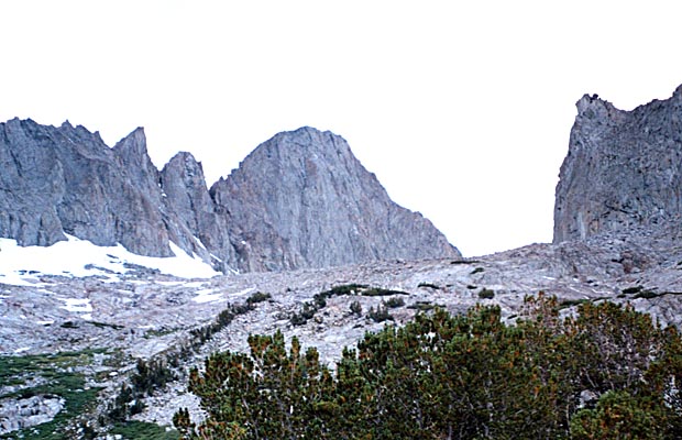
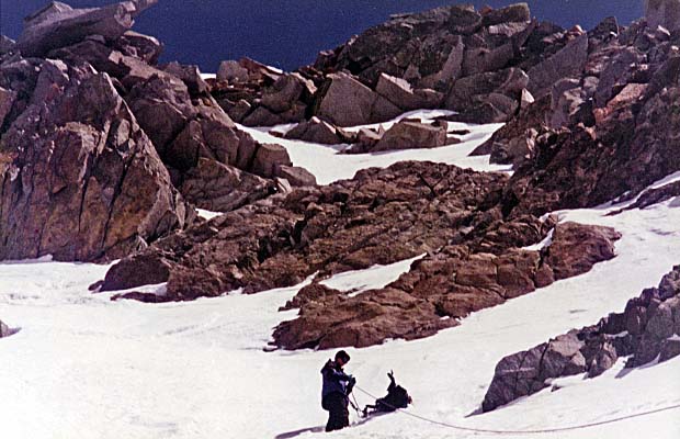
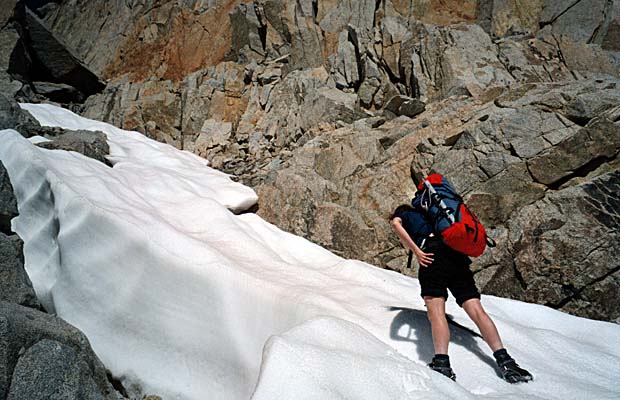
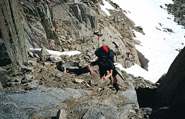
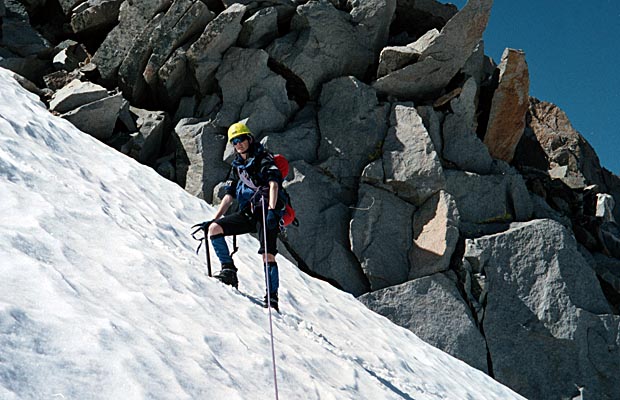
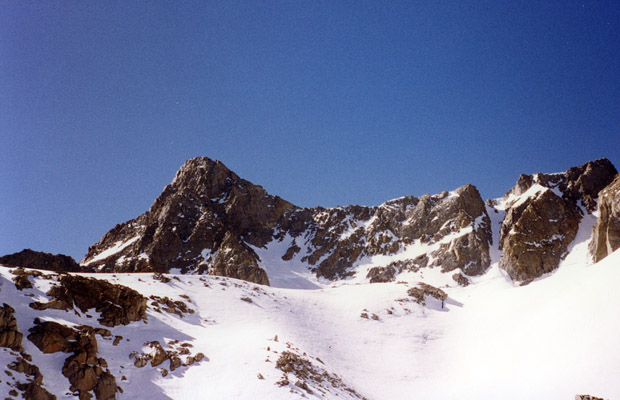
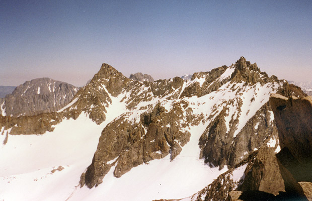
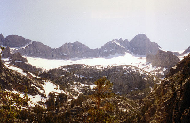
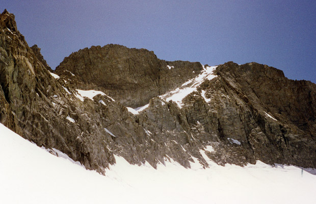
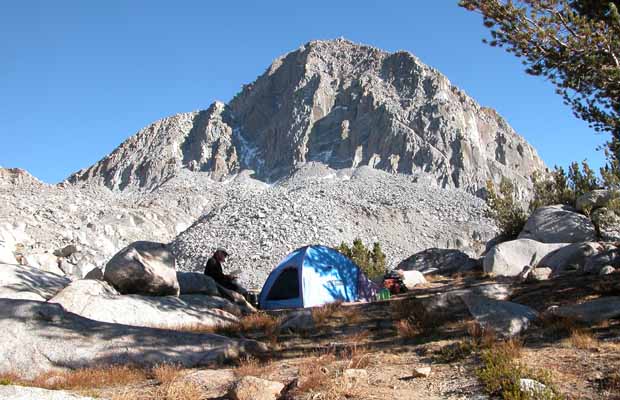
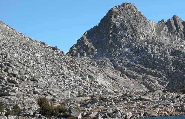
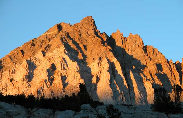
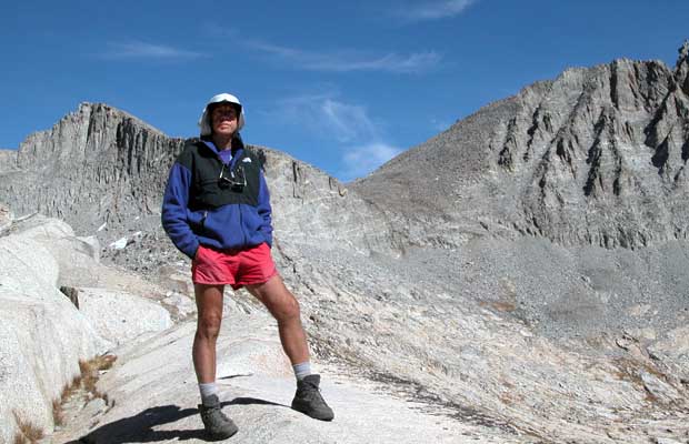
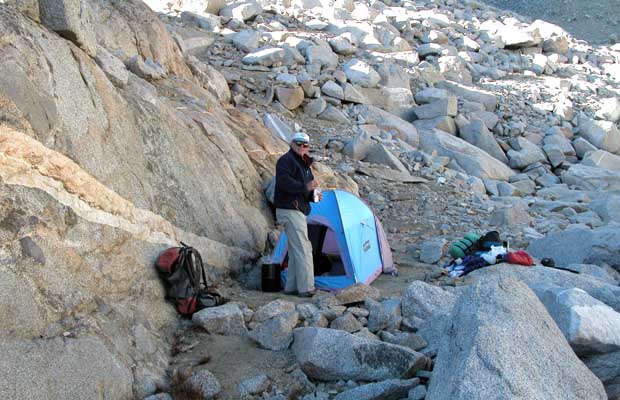
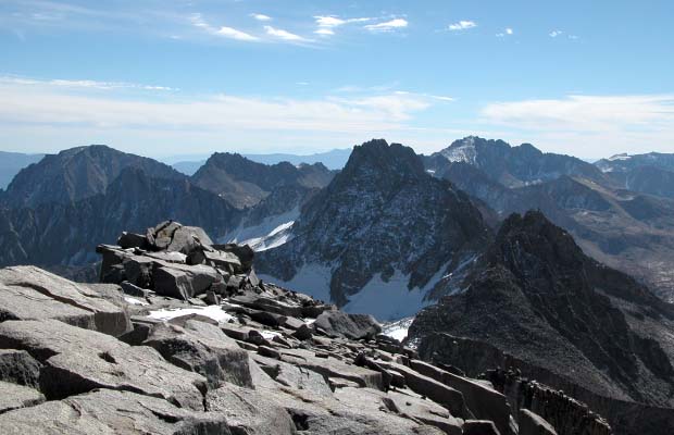
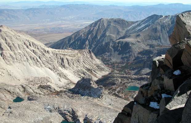
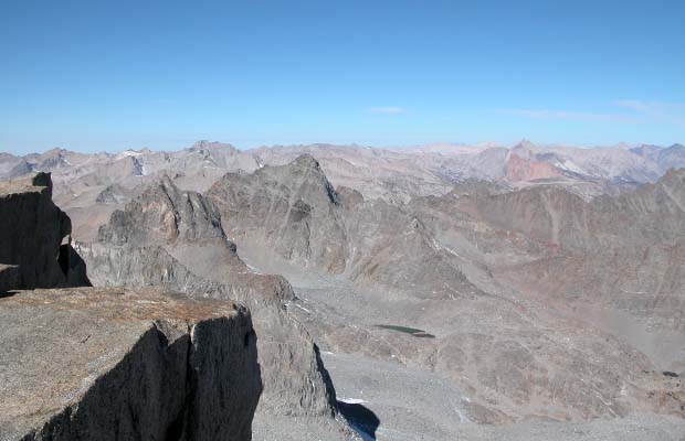
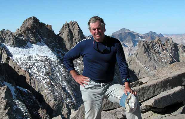
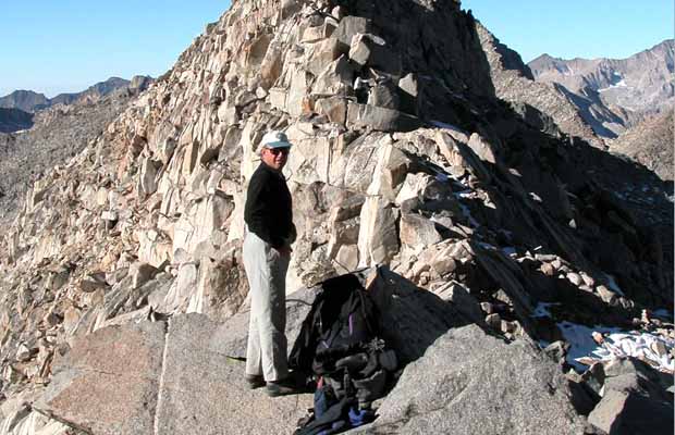
Notwithstanding, the four day climb in excellent weather was very demanding, placing all camps above 11,000 feet, including one at 12,400 feet. There are many places below the peak where we were threading our way through a three dimensional labyrinth of car sized boulders; each move potentially hazardous - a good reason to not be in these remote areas alone.

The last section of the climb - the 400 feet to the summit was a delight, despite a few route finding errors and the subsequent desperate (Jim's fine term for scary) moves required, particularly going back down. The guide book says that the summit of Mt Sill provides the best view from any peak in the Sierras and we weren't disappointed - the outlook was spectacular in all directions.

©PeterTremayne, Reno, NV 2012


See Also: Mount Sill - The Early Attempts

Return to To

latest news2020 | latest news2019 | latest news2018 | latest news2017 | home | main players | contact us | sierra nevada | jmt access map | jmt planning | 2024equipment | jmt schedules | jmt2016 | jmt 2015 | jmt 2014 | jmt 2013 | jmt 2012 | jmt 2011 | jmt 2010 | jmt 2009 | jmt 2008 | jmt 2007 | jmt 2006 | jmt 2005 | jmt 2004 | jmt 2002 | mt agassiz | mt sill | mt shasta | matterhorn peak | mt egmont | nz 2016 | mt rainier | mt shuksan | mt jefferson | pct sonora nth | pct tm nth | pct wa nth | mt baker | wonder trail | mera peak | mt adams | goat rocks | cascades 2003 | mt whitney | kaibab trail | presidents | antarctica | hoover pct | recesses | highrte2015 | highrte2016 | denali89 | benson lake | videos mp4 | tremaynes |