

PCT 2010: Sonora Pass to Echo Lake
Having hiked the PCT section from Sonora Pass south to Tuolumne Meadows in 2008, the plan to go northbound from the Pass to Lake Tahoe had been on the back-burner for two years. I figured this was the time; do it just before my annual attempt at the JMT … for fitness training and an equipment shakedown for another anticipated solo trip. Lacking good hiking maps along the route (no coverage by the Tom Harrison series), I used the mileage & water information from the PCT Data Book to plan my daily distances and overnight stops. Much later I discovered that National Geographic had produced detailed coverage in their Trails Illustrated series. Throughout the seven day, 77 mile trip I found it somewhat disconcerting travelling without good maps; missing the big picture, and little idea of what the terrain would be around each bend in the trail.
|
|
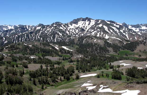
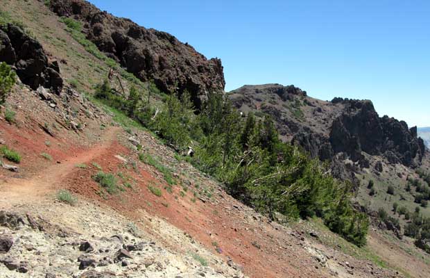
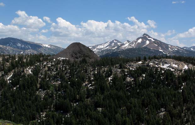
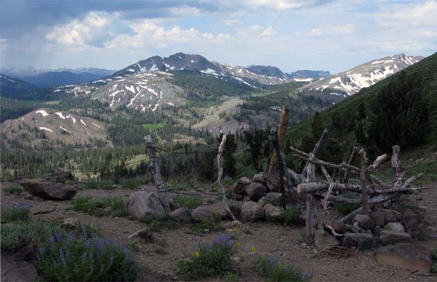
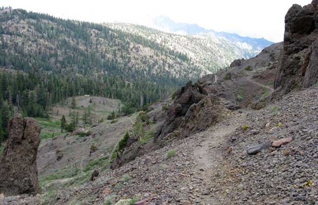
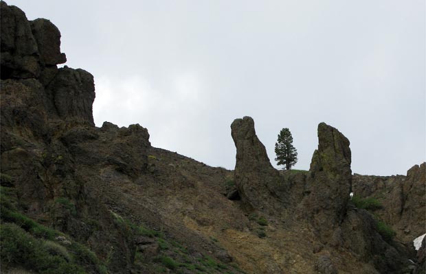
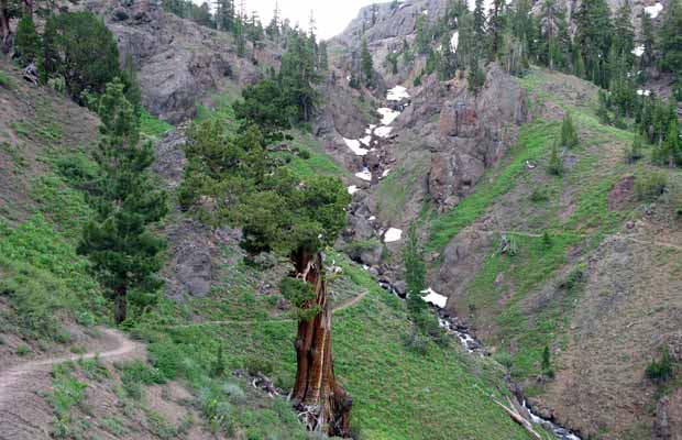
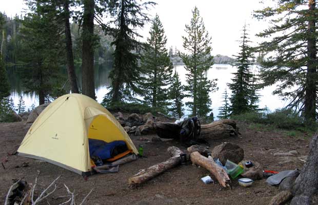

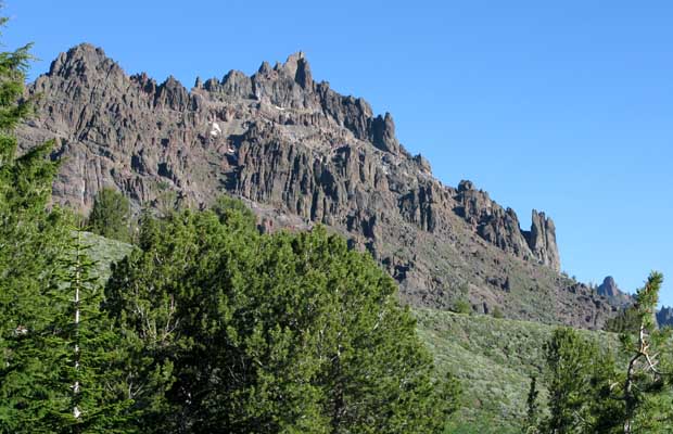
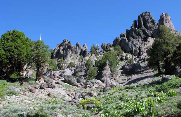
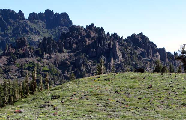
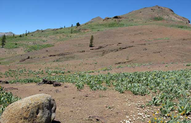
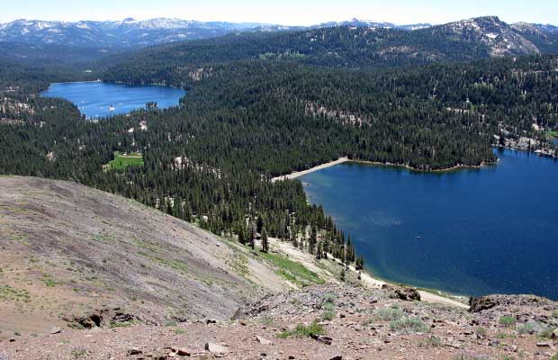
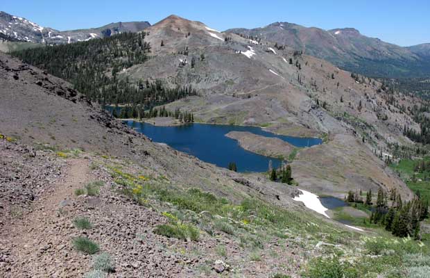
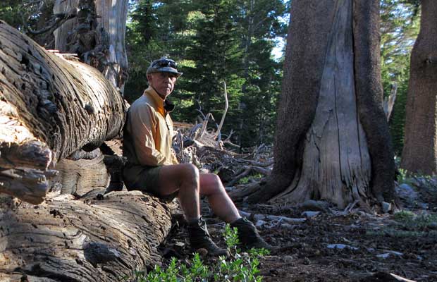
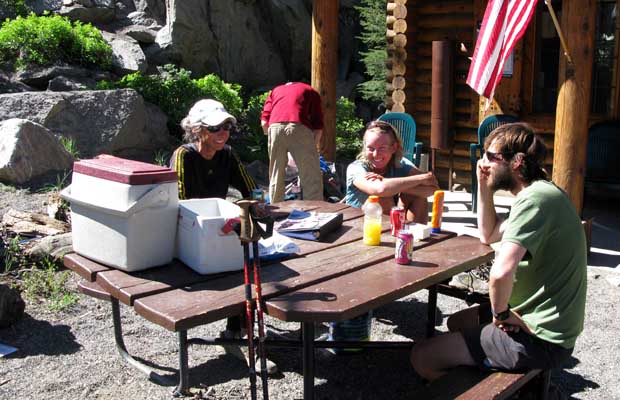
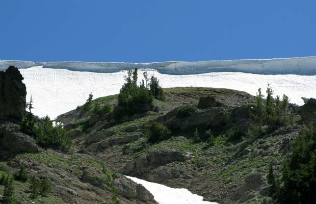
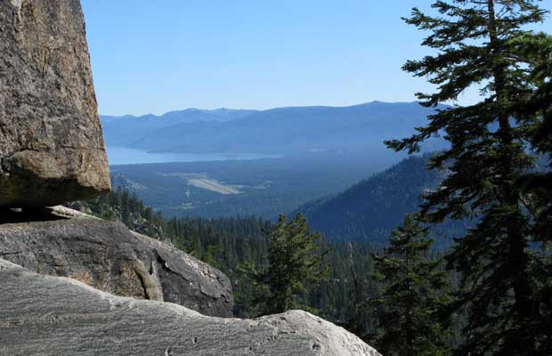
On the first day, I had a friend drop me off at Sonora Pass after completing a self-issue trail permit at Leavitt Meadows on Hwy 108. Heading north from the Pass involved a relatively easy ascent, traversing the southern face of Sonora Peak, with no snow problems until passing Wolf Creek Lake and descending into Granite Canyon. Once on the Canyon floor, hiking along the East Fork of the Carson River, without snow, staying on the trail was much easier. I stopped at a pleasant campsite between two small creeks, but was a little nervous of dead trees looming over the area. I’d elected not to carry a bear-proof canister, so felt it prudent to sling my food from a suitable branch. I’d forgotten just what a hassle this activity is, and considered the extra weight of a canister would have been welcome! My distance covered for day one had been 9.3 miles and not too strenuous, but the second day was tough. It began with a very steep climb out of the Canyon and continued for a total of 13 miles, descending and climbing for a cumulative ascent of 3,500’ by the time I reached an excellent campsite at Wolf Creek. I’d have to admit I made hard work of the day, possibly out of condition for the first long hike of the season, but also possessed of a physical lethargy throughout the day. I wondered whether it was a harbinger of the days and miles to come. As the days progressed, my daily efforts did improve, but the physical sluggishness did persist at a reduced level. Much of this discomfit was caused by my unfamiliarity with the terrain, exacerbated by the lack of maps, placing me in a moving environment that was unknown and couldn’t be anticipated, and therefore unable to pace myself during each day’s effort. The third day from Wolf Creek to Upper Lake Kinney, 11 miles, was across a picturesque volcanic landscape. Many ups and downs with a cumulative ascent of 3,150’. The PCT crosses Hwy 4 at Ebbets Pass, with some day-hiker PCT activity on each side of the Pass. My camp at Upper Kinney Lake was to be the best of the trip; few campers, warm lake water and granite slabs. I spent time talking with Dave and his barking dog, Tozer. The fourth day was easier, with long sections of level contouring around the eastern slopes of Reynolds and Raymond Peaks, followed by a long descent to Pleasant Valley Creek. This was not the best campsite; located in a hollow and swarming with mosquitoes and bees, but I didn’t have the energy to push on to the next indicated water source. As I discovered the next morning, numerous lakes and better campsites were only a short distance ahead … if only I’d had a map! Whereas the previous day’s hike had been through wondrous volcanic outcrops and rock pillars, the section of the PCT from my camp at Pleasant Valley to the crossing of Blue Lake Road was anything but pleasant. This was second growth forest and scrub surrounding a series of man-made lakes, heavily used by car campers and thick with mosquitoes. North of the road crossing, everything changed; climbing up and away from the lakes and day trippers, traversing under The Nipple and well above the Upper and Lower Blue Lakes, the PCT stays high until Forestdale Divide, where it drops down to a creek of the same name. This is where I camped for the night after a daily distance of 13 miles … a long day, but a good campsite not listed in the PCT Data Book. The next day’s hiking was possibly the highlight of the trip. My physical state had improved, with easier breathing and less leg/knee pains. Passed by two thru-hikers, Rick & Phil, who slipped on a steep snow crossing (I stayed below the snow slope!). They were wearing sneakers, but no Microspikes. I later met them at the Information Center at Carson Pass (on Hwy 88), in company with numerous other thru-hikers. Here, thanks to Trail Angel support, there was free soda (on ice) and chips for the likes of us … I gloried in my PCT section hiker status as “Yellowshirt”. Carson Pass was a great midday break, but I needed to push on for this second to last day if I hoped to reach Echo Lake on schedule. The PCT section north of Carson Pass was easy going, with long flat areas after an initial climb from Hwy 88 to a grassy saddle. However, after crossing the headwaters of the Truckee River, it was mostly climbing passing Showers Lake (where I should have camped!) to Bryan Meadow (where I couldn’t camp!) and finally a descent to a creek crossing above Benwood Meadow, where thankfully I found a great campsite. A daily total of 15 miles in 10 hours. |
|
|
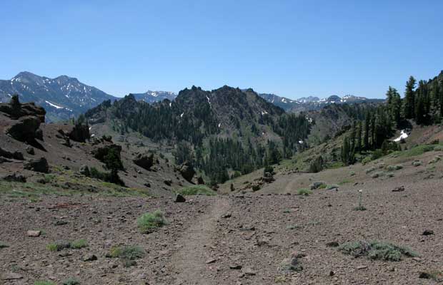
For my seventh and last day on the trail, I had only 3.5 miles to reach the road crossing on Hwy 50 … mostly downhill. This was an easy morning, but negotiating the convoluted PCT section between Hwy 50 and Echo Lake Resort was a pain. It consisted of unnecessary ups and downs through second growth foliage, and around cabins and other private enclosures. Next time I’ll follow the roads into the Resort. This seven day, 77 mile hike northbound on the PCT, was unlike anywhere else that I’d been in the Sierra range. There is granite in a few locations, but the terrain is mainly volcanic … lacking trees on the higher ridges and peaks. Where there’s granite, large stands of pines and firs proliferate: Juniper, Red & White Fir, Hemlock and Western White Pine and the ubiquitous Jeffery & Ponderosa Pines. Another difference from the High Sierra PCT/JMT section is the presence of roads about every two days hiking, allowing for frequent resupply and/or easy 2-3 day backpacking between the road crossings. ©Peter Tremayne, Reno NV 2010
|
Return to Top
latest news2020 | latest news2019 | latest news2018 | latest news2017 | home | main players | contact us | sierra nevada | jmt access map | jmt planning | 2024equipment | jmt schedules | jmt2016 | jmt 2015 | jmt 2014 | jmt 2013 | jmt 2012 | jmt 2011 | jmt 2010 | jmt 2009 | jmt 2008 | jmt 2007 | jmt 2006 | jmt 2005 | jmt 2004 | jmt 2002 | mt agassiz | mt sill | mt shasta | matterhorn peak | mt egmont | nz 2016 | mt rainier | mt shuksan | mt jefferson | pct sonora nth | pct tm nth | pct wa nth | mt baker | wonder trail | mera peak | mt adams | goat rocks | cascades 2003 | mt whitney | kaibab trail | presidents | antarctica | hoover pct | recesses | highrte2015 | highrte2016 | denali89 | benson lake | videos mp4 | tremaynes |