Walks in Wonderland: 2004 & 2006


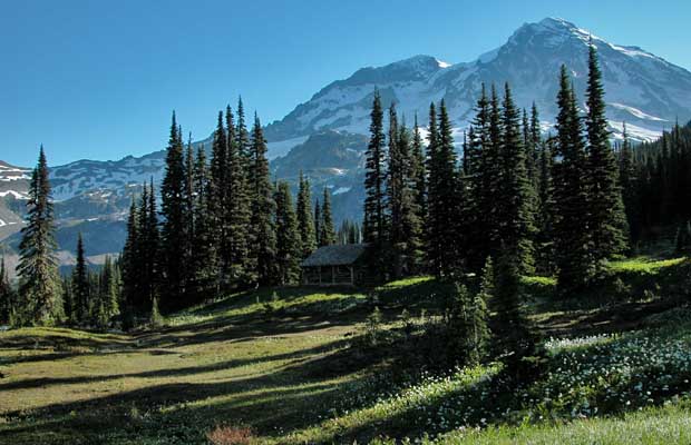
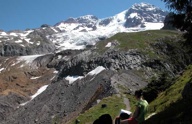
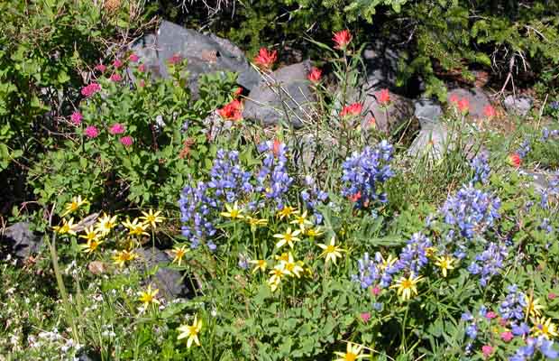
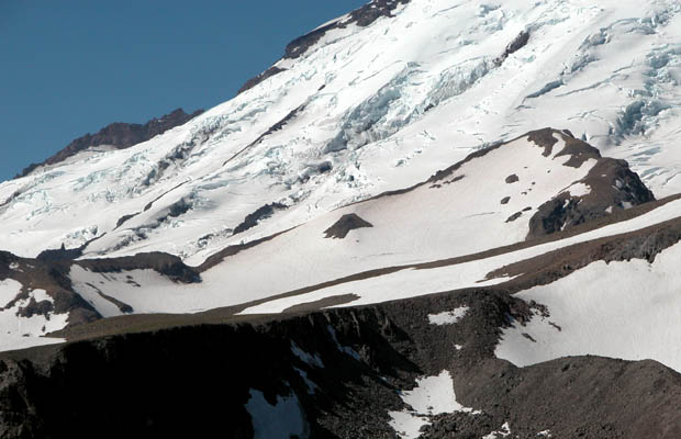
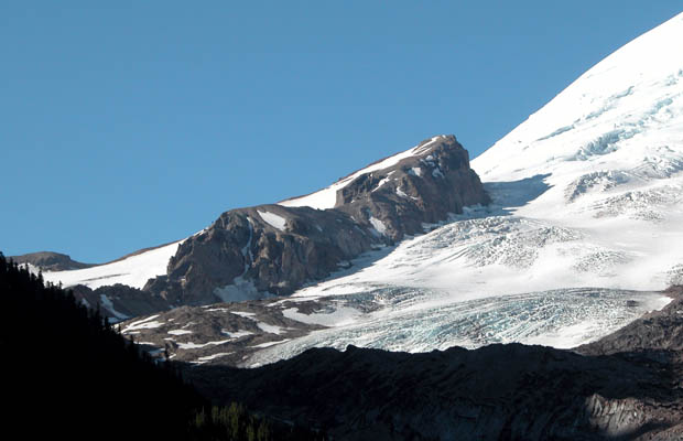
In early July 2004, Jim Slade contacted me with the offer of a grand adventure with no desperate climbing involved: He suggested we hike the Wonderland Trail, a 93 mile circuit around the base of Mount Rainier. The Rainier National Park map of the area recommends 11 to 14 days to complete the circuit, but Jim thought we could handle the task in 10 days. I guessed it would depend on snow conditions, particularly negotiating the numerous moraine gully walls. The map indicated we could re-supply at two points around the circuit, translating into 3 to 4 days maximum carry of food and fuel. Quoting from the back of my Rainier map, it states that "the Wonderland Trail encircles the mountain, passing through deep forests and crossing mountain passes, alpine meadows and glacial streams. Maximum elevation is 6,800' at Panhandle Gap; lowest elevation is 2,400' at Isput Creek. Because the trail crosses many ridges and valleys, daily elevation gain changes of over 3,500' are common. There are 17 trail side camps and three campground options located at 2 to 8 miles apart, providing a good day's hike for most backpackers given the terrain. Camps are mostly in forested areas to mitigate damage to meadows. The Wonderland Trail was built in the early 1900's”.

  • Peter at Panhandle Gap, 6,800' ... highest point on the Wonderland Trail. Peter at Panhandle Gap, 6,800' ... highest point on the Wonderland Trail.
  • Crossing Cowlitz River ... in the southeastern quadrant of Rainier National Park Crossing Cowlitz River ... in the southeastern quadrant of Rainier National Park
  • A black tailed stag visiting our campsite at Devil's Dream. A black tailed stag visiting our campsite at Devil's Dream.
  • The Ranger cabin at Indian Henry's Hunting Ground. The Tahoma glacier behind The Ranger cabin at Indian Henry's Hunting Ground. The Tahoma glacier behind
  • Jim and Peter at the high point on Emerald Ridge. The Tahoma Glacier above Jim and Peter at the high point on Emerald Ridge. The Tahoma Glacier above
  • An abundant display of white Avalanche Lilies and a scattering of the Magenta Paintbrush An abundant display of white Avalanche Lilies and a scattering of the Magenta Paintbrush
  • A lenticular cloud enveloping Sunset Ridge on the northwest face of Mt. Rainier A lenticular cloud enveloping Sunset Ridge on the northwest face of Mt. Rainier
  • Sunset Ridge and Sunset Amphitheater, with the white summit of Mt. Rainier to the right Sunset Ridge and Sunset Amphitheater, with the white summit of Mt. Rainier to the right
  • Aurora Lake at the Klapache Park campsite. By far the best camp we experienced. Aurora Lake at the Klapache Park campsite. By far the best camp we experienced.
  • Near our campsite at Golden Lakes. A beautiful area, but many mosquitos. Near our campsite at Golden Lakes. A beautiful area, but many mosquitos.
  • Fellow travellers, Chelsea and Carolyn, walking through a massive tree blow-down. Fellow travellers, Chelsea and Carolyn, walking through a massive tree blow-down.
  • Spray falls in the early morning ... a short hike from the Mowick Lake. Spray falls in the early morning ... a short hike from the Mowick Lake.
  • The northern face of Mt. Rainier. In the center, Ptarmigan Ridge, leading up to Liberty Cap. The northern face of Mt. Rainier. In the center, Ptarmigan Ridge, leading up to Liberty Cap.
  • The deadly Liberty Ridge climbing route The deadly Liberty Ridge climbing route
  • The swing-bridge across the Carbon River ... "one person at a time" The swing-bridge across the Carbon River ... "one person at a time"
  • The basic bridge over Winthrop Creek as it issues from the snout of Winthrop Glacier. The basic bridge over Winthrop Creek as it issues from the snout of Winthrop Glacier.
  • The icy snout of Carbon Glacier at an elevation of only 3,600'. The icy snout of Carbon Glacier at an elevation of only 3,600'.
  • The icy source of the Carbon River The icy source of the Carbon River
  • A marmot cooling off on the snow. A marmot cooling off on the snow.
  • Dueling marmots ... or whatever they're doing? Cute little critters, but pesky! Dueling marmots ... or whatever they're doing? Cute little critters, but pesky!
  • End of journey. Peter and Jim back at White River campground ... 95 miles in 10 days. End of journey. Peter and Jim back at White River campground ... 95 miles in 10 days.
{image.index} / {image.total}

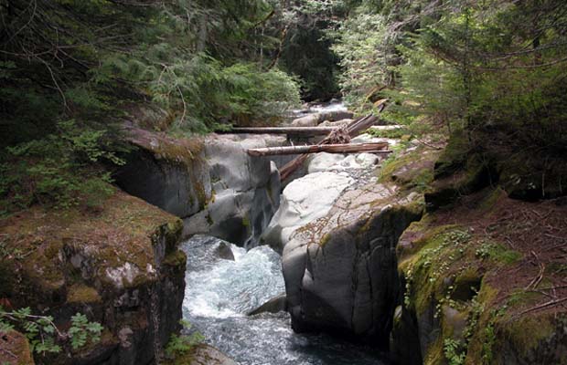
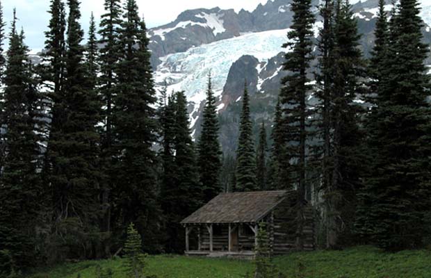
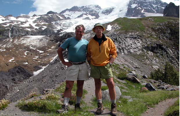
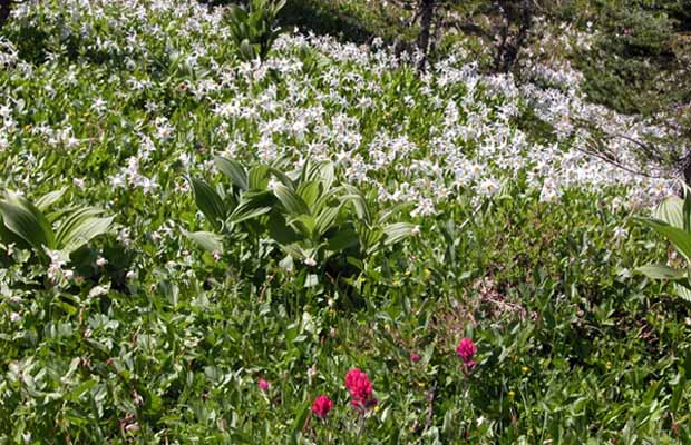
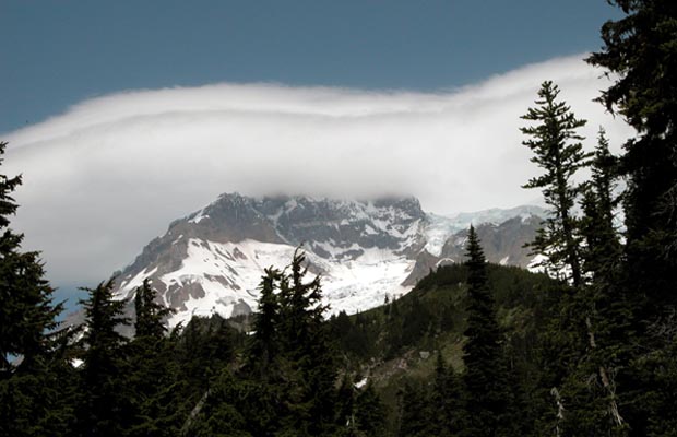
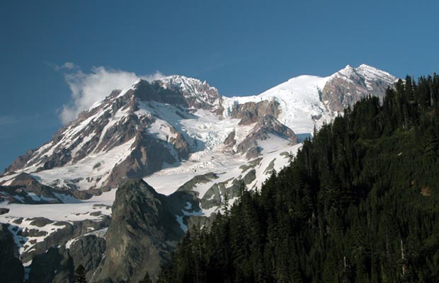
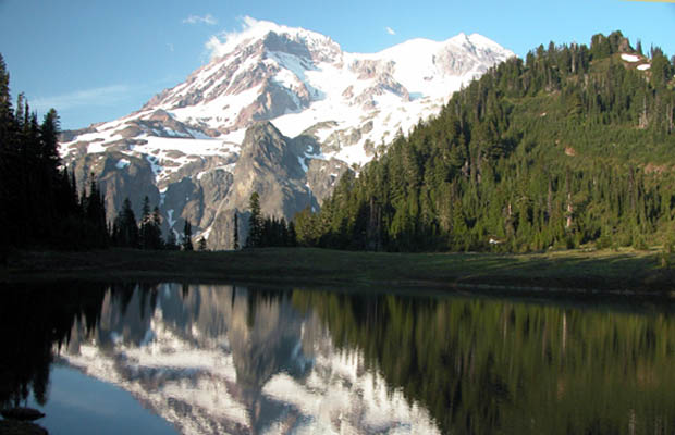
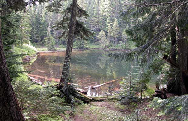
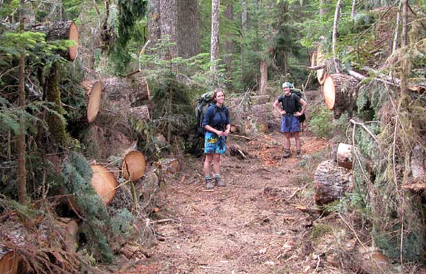
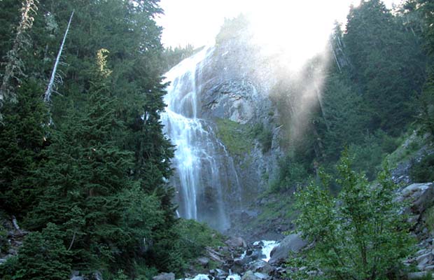
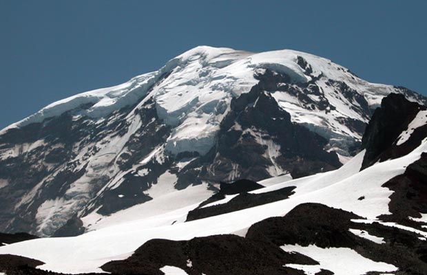
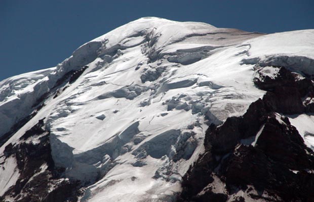
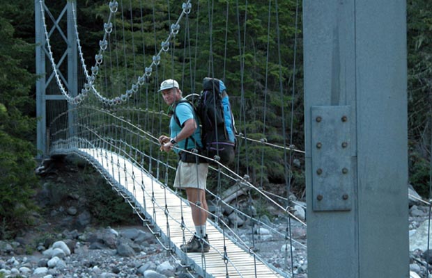
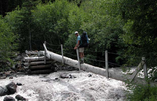
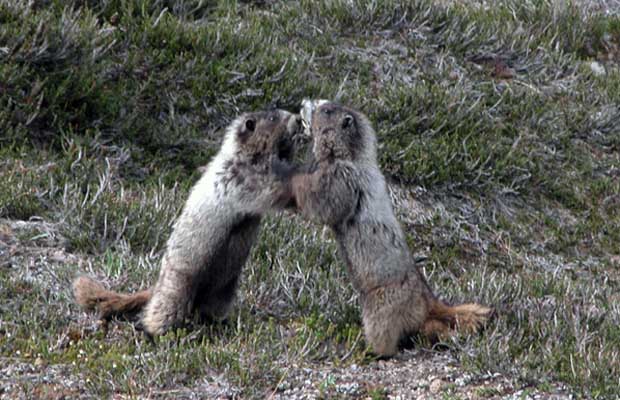
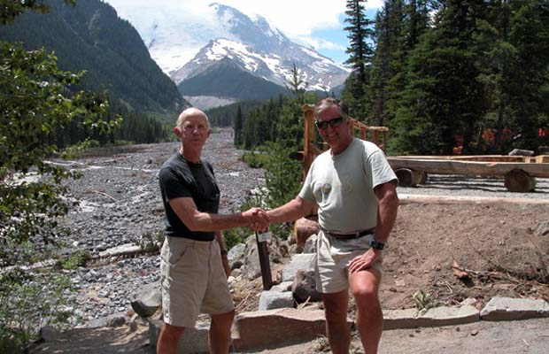
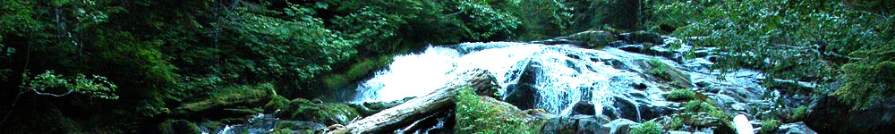
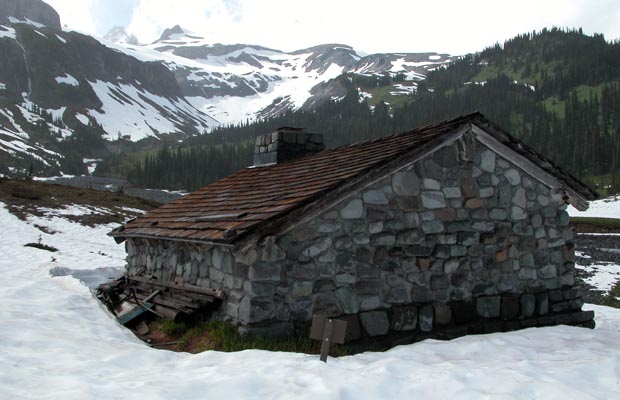
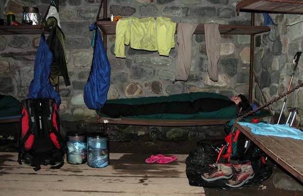
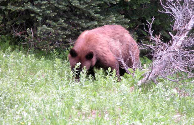
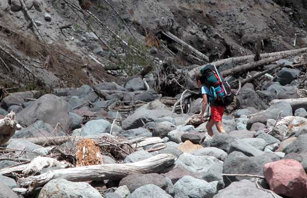
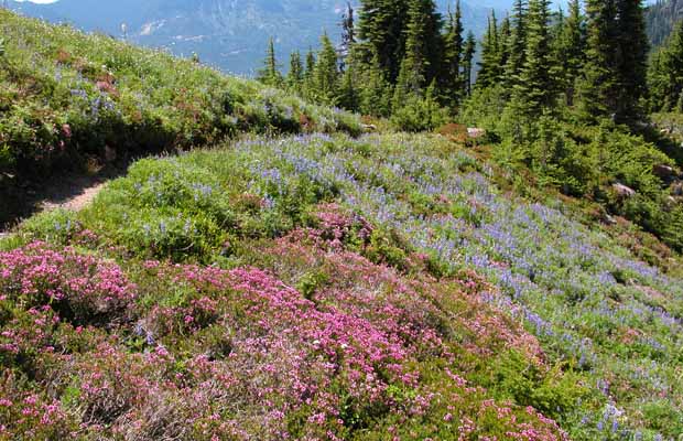
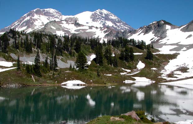
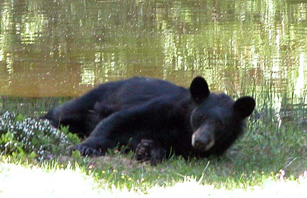
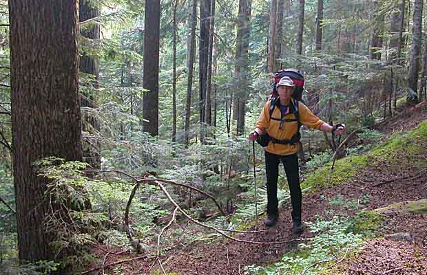
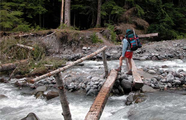
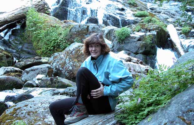
That's the official story. In reality, it's an extremely tough assignment to complete the circuit in less than 10 days, as we did; pushing on each day without layovers, averaging 10 miles daily and recording elevation gains on some sections of 4,500'. And we wondered how successful was the average hiker who sets out to complete the Trail in one trip. Jim Slade and I met a number of small groups during the first few days of our journey; moving counter-clockwise against our clockwise progress. We expected to pass them again on the other side, but nary a sign, with the exception of one hardy couple from Minnesota and a small party of US Army Rangers. We suspected the success rate was quite low with many folks electing to do the Trail over a period of years, breaking it down into quarters or thirds.

The forest camps are no fun; buried in big trees and alive with mosquitos. I would rather have camped on the high alpine meadows, but that's not permitted and anyway there's very few flat spots along the trail. It's ravines, steep ridges, glacial streams in flood with moving boulders sounding like thunder beneath the raging water ... and rickety bridges that frequently get washed away. The weather wasn’t brilliant, but we kept reminding ourselves that this was the Pacific Northwest and not California. We experienced little rain, but sadly the mountain remained hidden under layers of cloud for most of the trip. I lost ten pounds during the trip which tells me that our daily calorie burn was in the 4500 - 5000 range, because our fixed daily intake was no more than 2000 calories, limited by pack weight and re-supply arrangements. It lacks the vistas and great weather of the John Muir Trail, but the Wonderland Trail is a unique and demanding long distance hike .


  • The stone hut at Indian Bar. The snow covered ridges we'd descended above. The stone hut at Indian Bar. The snow covered ridges we'd descended above.
  • Lucy warming up and drying out in the Indian Bar three sided hut. Lucy warming up and drying out in the Indian Bar three sided hut.
  • A cinnamon colored black bear encountered by the side of the trail, south of Indian Bar A cinnamon colored black bear encountered by the side of the trail, south of Indian Bar
  • Lucy crossing the deep wash-out of the Kautz Creek ... a stumble over large boulders. Lucy crossing the deep wash-out of the Kautz Creek ... a stumble over large boulders.
  • The Ranger cabin at Indian Henry's Hunting Ground. Mount Rainier behind. The Ranger cabin at Indian Henry's Hunting Ground. Mount Rainier behind.
  • The suspension bridge that crosses the deep wash-out of Tahoma Creek The suspension bridge that crosses the deep wash-out of Tahoma Creek
  • Crossing the high point of Emerald Ridge ... Tahoma glacier in the background. Crossing the high point of Emerald Ridge ... Tahoma glacier in the background.
  • Alpine wildflowers: scarlet and magenta paintbrush mixed with lupine and yellow arnica. Alpine wildflowers: scarlet and magenta paintbrush mixed with lupine and yellow arnica.
  •  A prolific display of alpine wildflowers on Emerald Ridge. A prolific display of alpine wildflowers on Emerald Ridge.
  • Looking east over St.Andrew's Lake towards the peaks of Mount Rainier Looking east over St.Andrew's Lake towards the peaks of Mount Rainier
  • A large black bear surprised by our arrival at the Golden Lakes campsite. A large black bear surprised by our arrival at the Golden Lakes campsite.
  • Time for a well fed bear to lie down in the shade. Time for a well fed bear to lie down in the shade.
  • Peter on the long descent through Douglas Fir forest from the Golden Lake's campsite. Peter on the long descent through Douglas Fir forest from the Golden Lake's campsite.
  • Lucy crossing one of the safer sections of the glacier fed Mowich River. Lucy crossing one of the safer sections of the glacier fed Mowich River.
  • Mowich Lake, a campsite that has road access and a large number of car campers.  Mowich Lake, a campsite that has road access and a large number of car campers.
  • Lucy at the base of the cascade that runs down from Spray Park into the Carbon River. Lucy at the base of the cascade that runs down from Spray Park into the Carbon River.
  • Lucy relaxing at our Tree-fall City campsite, a confusing area of tumbled logs. Lucy relaxing at our Tree-fall City campsite, a confusing area of tumbled logs.
  • The Inter Glacier that provides access to Camp Schurman The Inter Glacier that provides access to Camp Schurman
  • Steamboat Prow that supports the Inter Glacier ...Camp Schurman at the base of the Prow Steamboat Prow that supports the Inter Glacier ...Camp Schurman at the base of the Prow
  • On the home stretch, photographed near Sunrise, with only two hours left to finish. On the home stretch, photographed near Sunrise, with only two hours left to finish.
{image.index} / {image.total}

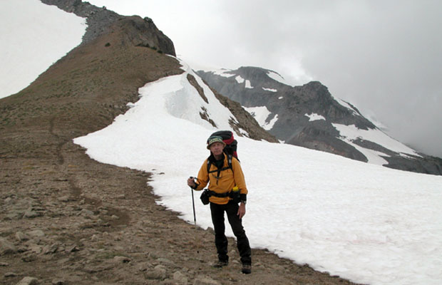
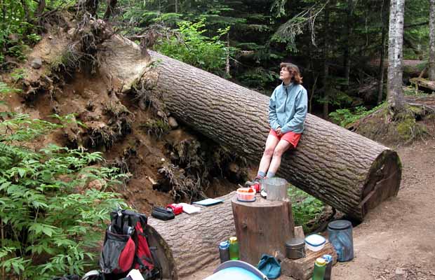
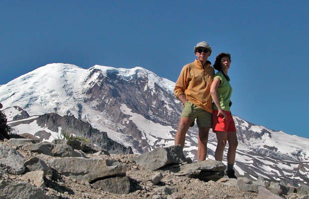
In July 2006, I made a return visit to the Wonderland Trail in the company of my wife Lucy. With some variation in the assigned campsites, we completed the circuit clockwise from White River campsite in the same 10 days. The first two days from White River to Maple Creek were made difficult ... route finding in deep snow and poor visibility from Panhandle Gap, past Indian Bar, to the Cowlitz Divide Trail intersection.

As in 2004, Lucy and I chose the Spray Park Trail option between Mowich Lake and Carbon River campsites. Route finding through this section was also difficult because of snow, but helped by my knowledge from the 2004 trip. The mid- July period for hiking the Wonderland Trail does provide snow problems, but limits the demand for campsite permits ... the main reason for choosing this time frame for both our trips.

Lucy and I did carry ice-axes for the 2006 venture - which proved useful- but a GPS would have been an asset during our two first days on the Trail.

See the 2006 Schedule

©Peter Tremayne, Reno NV 2012


Return to Top

latest news2020 | latest news2019 | latest news2018 | latest news2017 | home | main players | contact us | sierra nevada | jmt access map | jmt planning | 2024equipment | jmt schedules | jmt2016 | jmt 2015 | jmt 2014 | jmt 2013 | jmt 2012 | jmt 2011 | jmt 2010 | jmt 2009 | jmt 2008 | jmt 2007 | jmt 2006 | jmt 2005 | jmt 2004 | jmt 2002 | mt agassiz | mt sill | mt shasta | matterhorn peak | mt egmont | nz 2016 | mt rainier | mt shuksan | mt jefferson | pct sonora nth | pct tm nth | pct wa nth | mt baker | wonder trail | mera peak | mt adams | goat rocks | cascades 2003 | mt whitney | kaibab trail | presidents | antarctica | hoover pct | recesses | highrte2015 | highrte2016 | denali89 | benson lake | videos mp4 | tremaynes |