2015 High Time on Roper's High Route

and What happens at VVR


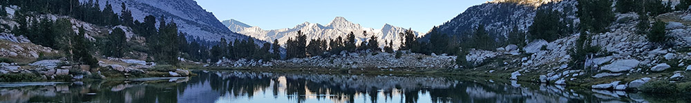
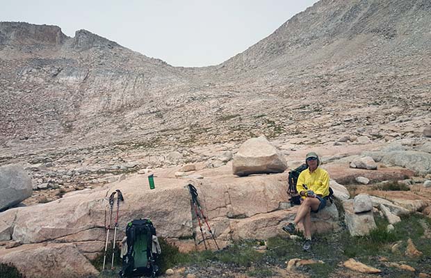
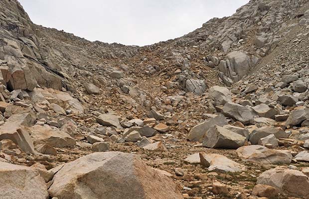
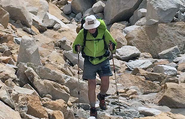
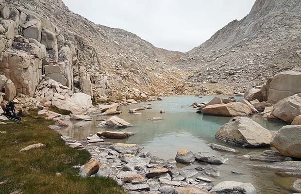
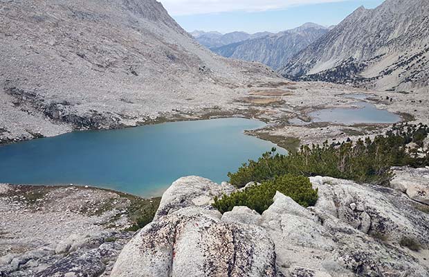
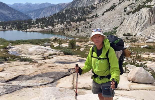
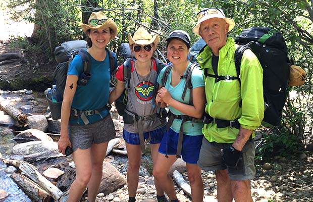
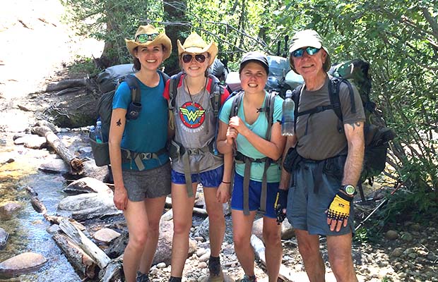
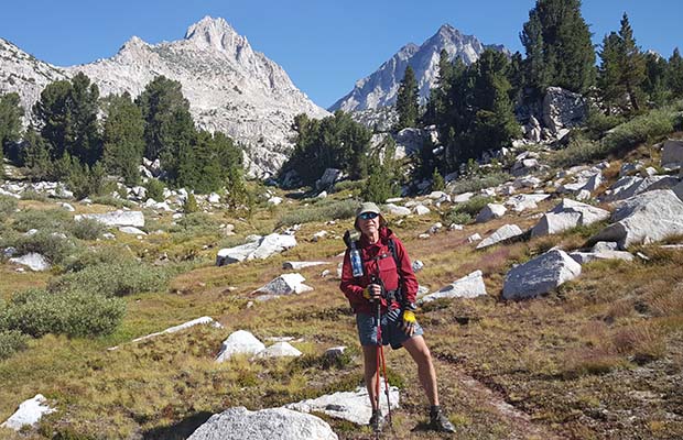
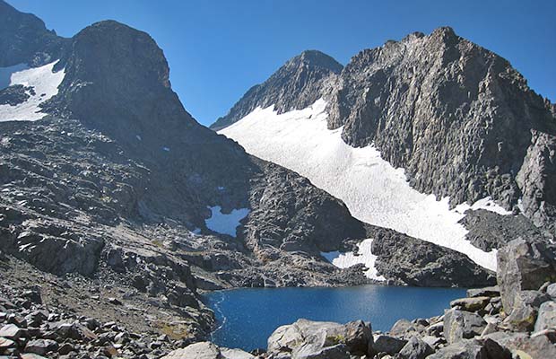
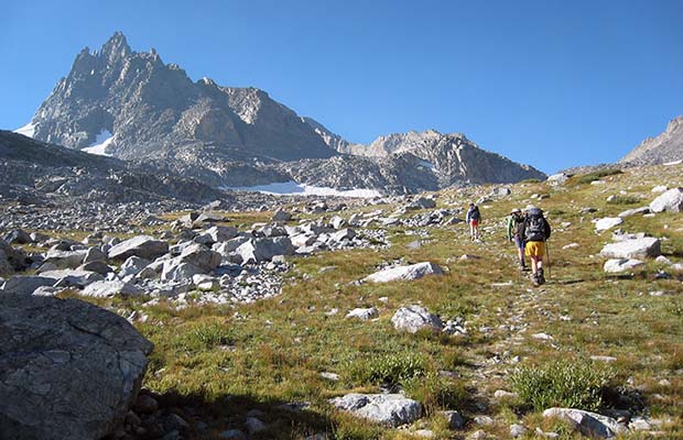
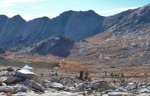
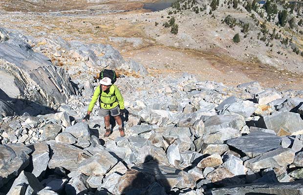
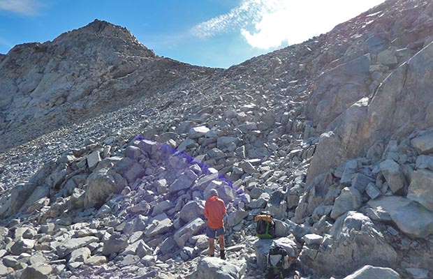
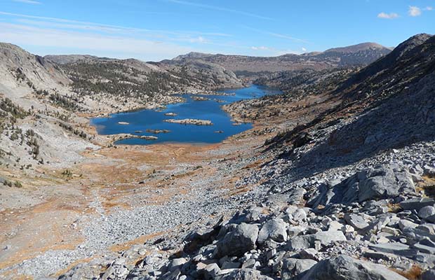
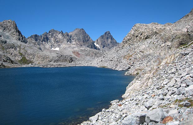
Hiking and climbing Steve Roper's Sierra High Route has always been a secret desire of mine. In 2002, I became familiar with the section between Dusy Basin and Cirque Pass, primarily for the purpose of climbing Mounts' Sill and Jepson. Then in 2007, in company with my wife and two Aussie climbing mates, completed the section from North Glacier Pass to Minaret Lake. However, on that attempt, we chickened out on crossing Whitebark Pass; instead moving back to the JMT along Garnet Lake and then to Lake Ediza via the Shadow Lake Trail.

Last year, in July 2014, I found a suitable hiking partner who was crazy enough to join me on further attempts of High Route sections. The big question: Could we do it as septuagenarians [me at 75 and Bob Williams at 74]. We started safe and easy by climbing into the Second Recess with the goal of reaching Italy Lake and beyond. In the event we were rained off, bailing out over Mono Pass in a thunderstorm.

  • Looking south from Granite Park to Pine Creek Pass Looking south from Granite Park to Pine Creek Pass
  • Looking north into Granite Park from the Italy Lake Trail Looking north into Granite Park from the Italy Lake Trail
  • Bob resting on the southern side of Italy Pass ... the low point on the skyline Bob resting on the southern side of Italy Pass ... the low point on the skyline
  • Bob climbing the last section of Italy Pass [12,400'] from the southern side Bob climbing the last section of Italy Pass [12,400'] from the southern side
  • Peter battling his hated talus ... this time along the southern shore of Lake Italy Peter battling his hated talus ... this time along the southern shore of Lake Italy
  • Our campsite at the western end of Lake Italy Our campsite at the western end of Lake Italy
  • More talus along the northern shore of Lake Italy More talus along the northern shore of Lake Italy
  • The eastern end of Lake Italy The eastern end of Lake Italy
  • Toe Lake at the eastern end of Lake Italy Toe Lake at the eastern end of Lake Italy
  • Looking up to the southern side of Gabbot Pass from Toe Lake Looking up to the southern side of Gabbot Pass from Toe Lake
  • Relaxing on Gabbot Pass before stumbling down into the Mills Creek drainage Relaxing on Gabbot Pass before stumbling down into the Mills Creek drainage
  • The hated talus on the northern side of Gabbot Pass on the High Route The hated talus on the northern side of Gabbot Pass on the High Route
  • Peter battling his hated talus on the northern side of Gabbot Pass Peter battling his hated talus on the northern side of Gabbot Pass
  • Looking south to Gabbot Pass from above Upper Mills Creek Lake Looking south to Gabbot Pass from above Upper Mills Creek Lake
  • Upper Mills Creek Lake from just below Gabbot Pass Upper Mills Creek Lake from just below Gabbot Pass
  • Approaching Lower Mills Lake ... our campsite for the night Approaching Lower Mills Lake ... our campsite for the night
  • Descending into the Second Recess from Mills Creek Lakes Descending into the Second Recess from Mills Creek Lakes
  • The waterfall at the base of the steep descent into the Second Recess The waterfall at the base of the steep descent into the Second Recess
  • Crossing Mono Creek from the Second Recess ... happy to be off the High Route for a few days Crossing Mono Creek from the Second Recess ... happy to be off the High Route for a few days
{image.index} / {image.total}


  • The welcome sign to Vermilion Valley Resort [VVR] The welcome sign to Vermilion Valley Resort [VVR]
  • Waiting for the ferry on what remains of Lake Edison [2015] Waiting for the ferry on what remains of Lake Edison [2015]
  • Waiting for the ferry on what remains of Lake Edison [2014]. Peter and Big Rob from Boston Waiting for the ferry on what remains of Lake Edison [2014]. Peter and Big Rob from Boston
  • The outside bar and dining alcove at VVR The outside bar and dining alcove at VVR
  • Bob and Peter's tents at VVR hiker campground [2015] Bob and Peter's tents at VVR hiker campground [2015]
  • How do I eat all this food?  Yvonne from Germany [2012] How do I eat all this food? Yvonne from Germany [2012]
  • This is better than trail-food and pond water! Peter, Jeanne and Mike at VVR [2012] This is better than trail-food and pond water! Peter, Jeanne and Mike at VVR [2012]
  • Peter with VVR girls: Lightning, Nighthawk and Notat. Peter with VVR girls: Lightning, Nighthawk and Notat.
  • Jeanne and David with PCT thu-hikers sitting around the evening fire [2014] Jeanne and David with PCT thu-hikers sitting around the evening fire [2014]
  • Bob doing his yoga thing on a stump in the VVR hiker campground Bob doing his yoga thing on a stump in the VVR hiker campground
  • Bob with VVR girls: Lightning, Nighthawk and Notat Bob with VVR girls: Lightning, Nighthawk and Notat
  • VVR hiker campground neighbors: Eric and Emily from Toronto [2015] VVR hiker campground neighbors: Eric and Emily from Toronto [2015]
  • Bob and Peter's tents at VVR hiker campground [2015] Bob and Peter's tents at VVR hiker campground [2015]
  • Back on the High Route: On our climb to Laurel Lake.  Red and White Mountain behind. Back on the High Route: On our climb to Laurel Lake. Red and White Mountain behind.
  • The remote Grinnell Lake that's above Laurel Lake The remote Grinnell Lake that's above Laurel Lake
  • Bob hanging over a bluff below Bighorn Pass Bob hanging over a bluff below Bighorn Pass
  • Peter on Bighorn Pass on the High Route Peter on Bighorn Pass on the High Route
  • Bob on the western side of Bighorn Pass. Rosy Finch Lake below. Bob on the western side of Bighorn Pass. Rosy Finch Lake below.
{image.index} / {image.total}


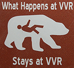
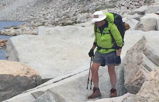
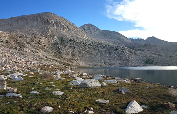
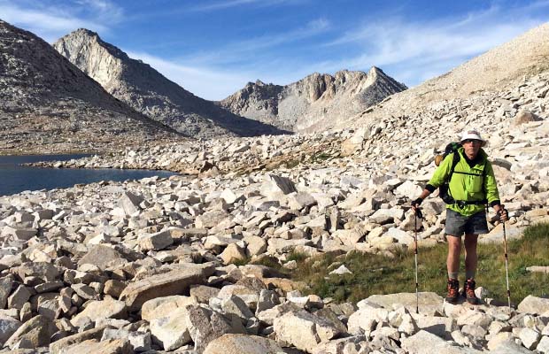
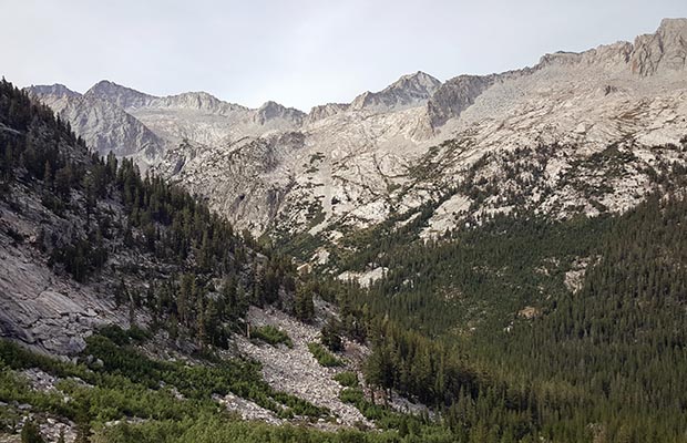
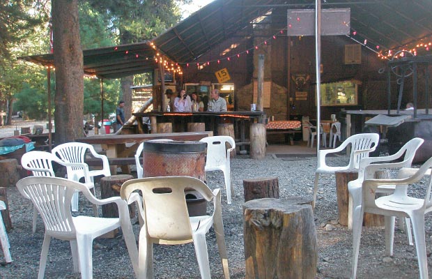
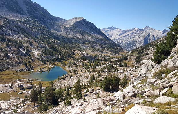
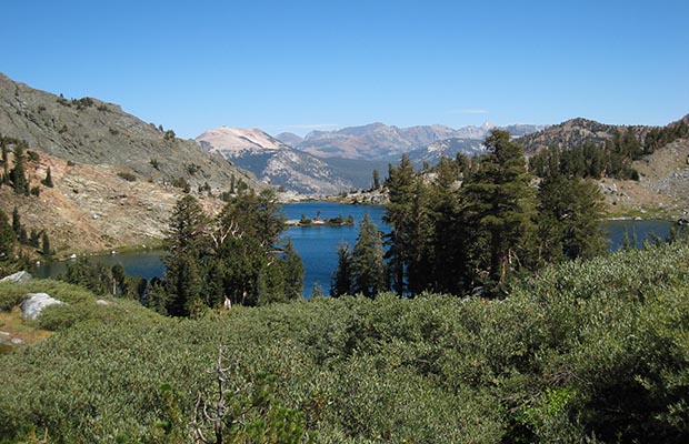
This year, 2015, we made a more serious attempt at doing sections of the High Route ... and succeeded. It was an absolute joy to be away from the JMT crowds during July and August ... and away from mule-trains ... and away from the horse-manure camps with their fat and lazy clients. And so it became evident why Steve Roper had been driven to discover a cross country route that closely paralleled the JMT, but too difficult and hazardous for the average hiker or mules and horses.

During breaks between our High Route sections, we used Vermilion Valley Resort [VVR] for resupply and rest days. Since 2002, on my first JMT thru-hike, I've been a constant visitor to VVR, enjoying the restaurant meals, hot showers and camaraderie of fellow thru-hikers. This year was no exception: Bob and I were there on two occasions, hiking in from the Mono Recesses and later over Goodale Pass during our annual JMT thru-hike. Jim [the Owner] and his staff were excellent hosts for our two extended stays at VVR.


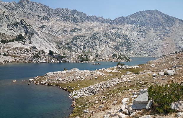
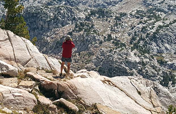
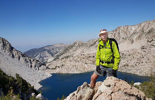
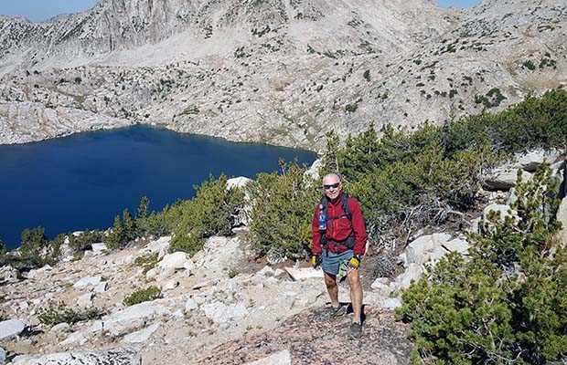
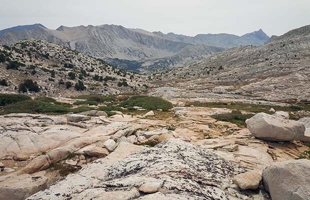
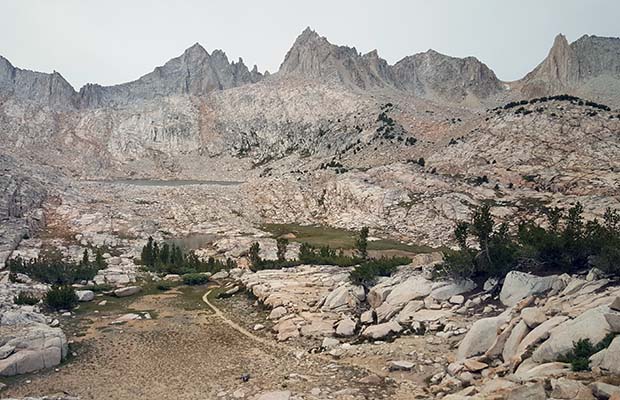
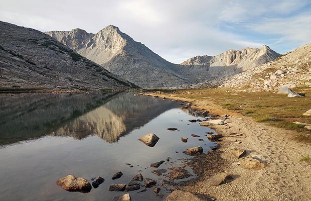
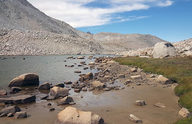
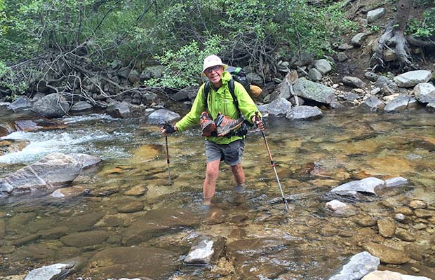
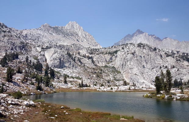
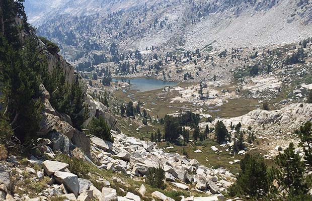
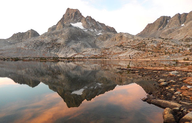
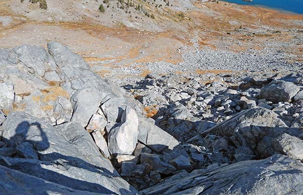
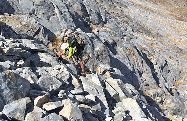
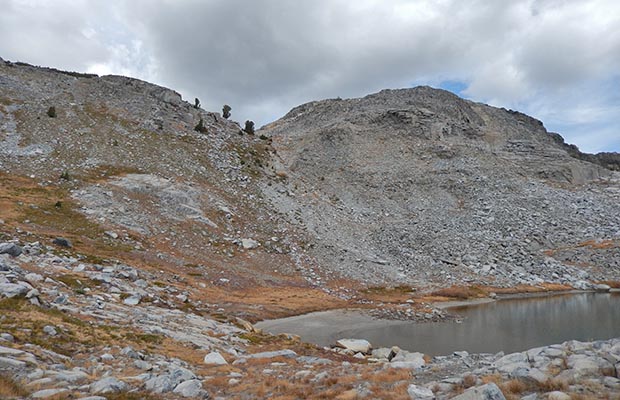
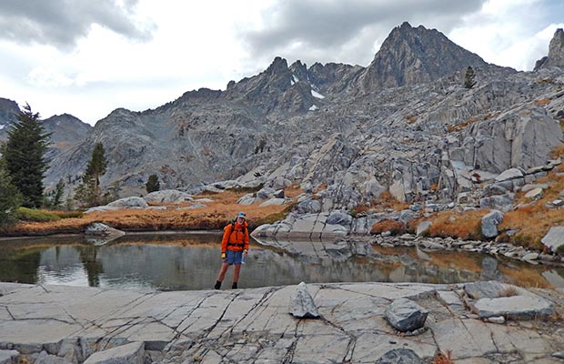
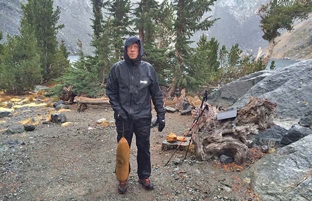
Our first 2015 High Route section was between Lake Italy and the McGee Pass Trail. This took a total of eleven days that included a rest day at VVR. Then later, during October, between Thousand Island Lake and Minaret Lake, cut short at Iceberg Lake by rain and snow. We found a Class 3-4 route up the northern side of Whitebark Pass, but suspect it was too far west of the recommended route. Then made a silly mistake from Nydiver Lakes to Lake Ediza [direct down the bluffs]. I should have known better ... I'd climbed Banner and Ritter from the obvious trail in past years!

On reaching Iceberg Lake, we decided to camp there and do a day hike up to Cecile Lake the following morning, return to Iceberg, pack-up and head out to Agnew Meadows to beat the threatening weather. In the event, come morning the rain arrived, with snow settling on the peaks above, so by 8 am we were down the hill to Agnew in constant heavy rain. Sadly the end of our summer season in the High Sierra.


©2015 Peter Tremayne, Reno NV


  • Half way up the climb from Laurel Lake to Bighorn Pass Half way up the climb from Laurel Lake to Bighorn Pass
  • Laurel Lake, looking north to Red and White Mountain Laurel Lake, looking north to Red and White Mountain
  • Laurel Lake from the north, descending cross-country from Grinnell Lake Laurel Lake from the north, descending cross-country from Grinnell Lake
  • Lake Catherine as seen from North Glacier Pass - on the High Route Lake Catherine as seen from North Glacier Pass - on the High Route
  • The route up to North Glacier Pass and Catherine Lake The route up to North Glacier Pass and Catherine Lake
  • Banner Peak from the west end of Thousand Island Lake - close to the High Route Banner Peak from the west end of Thousand Island Lake - close to the High Route
  • The west end of Thousand Island Lake as seen from Garnet Pass - on the High Route The west end of Thousand Island Lake as seen from Garnet Pass - on the High Route
  • Whitebark Pass as seen from the southern side of Garnet Pass - on the High Route Whitebark Pass as seen from the southern side of Garnet Pass - on the High Route
  • The climb of Whitebark Pass from the northern side - slightly off-route on the High Route The climb of Whitebark Pass from the northern side - slightly off-route on the High Route
  • Where to now? Slightly off-route on the High Route Where to now? Slightly off-route on the High Route
  • No place for a 76 year old guy with titanium knees! Slightly off-route on the High Route No place for a 76 year old guy with titanium knees! Slightly off-route on the High Route
  • Almost to the summit of Whitebark Pass - slightly off-route on the High Route Almost to the summit of Whitebark Pass - slightly off-route on the High Route
  • Looking back to the east along the length of Garnet Lake - view from Whitebark Pass. Looking back to the east along the length of Garnet Lake - view from Whitebark Pass.
  • The southern side of Whitebark Pass which drops down to the Nydiver Lakes The southern side of Whitebark Pass which drops down to the Nydiver Lakes
  • Bob by a no-name pond amongst the bluffs between the Nydiver and Ediza lakes Bob by a no-name pond amongst the bluffs between the Nydiver and Ediza lakes
  • Iceberg Lake with the Minarets behind - on the High Route Iceberg Lake with the Minarets behind - on the High Route
  • Lake Cecile with Ritter and Banner peaks behind - on the High Route. Lake Cecile with Ritter and Banner peaks behind - on the High Route.
  • Minaret Lake on the High Route down from Lake Cecile. Minaret Lake on the High Route down from Lake Cecile.
  • Lets get out of here! Packing up in the rain at Iceberg Lake Lets get out of here! Packing up in the rain at Iceberg Lake
  • With our good Samaritans, Paul and Nancy, who helped us get back to our car at Silver Lake With our good Samaritans, Paul and Nancy, who helped us get back to our car at Silver Lake
{image.index} / {image.total}


Back to Top


latest news2020 | latest news2019 | latest news2018 | latest news2017 | home | main players | contact us | sierra nevada | jmt access map | jmt planning | 2024equipment | jmt schedules | jmt2016 | jmt 2015 | jmt 2014 | jmt 2013 | jmt 2012 | jmt 2011 | jmt 2010 | jmt 2009 | jmt 2008 | jmt 2007 | jmt 2006 | jmt 2005 | jmt 2004 | jmt 2002 | mt agassiz | mt sill | mt shasta | matterhorn peak | mt egmont | nz 2016 | mt rainier | mt shuksan | mt jefferson | pct sonora nth | pct tm nth | pct wa nth | mt baker | wonder trail | mera peak | mt adams | goat rocks | cascades 2003 | mt whitney | kaibab trail | presidents | antarctica | hoover pct | recesses | highrte2015 | highrte2016 | denali89 | benson lake | videos mp4 | tremaynes |