The 2016 High Route Escapade:

Tully Lake to Mono Creek


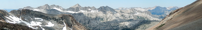
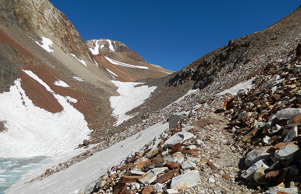
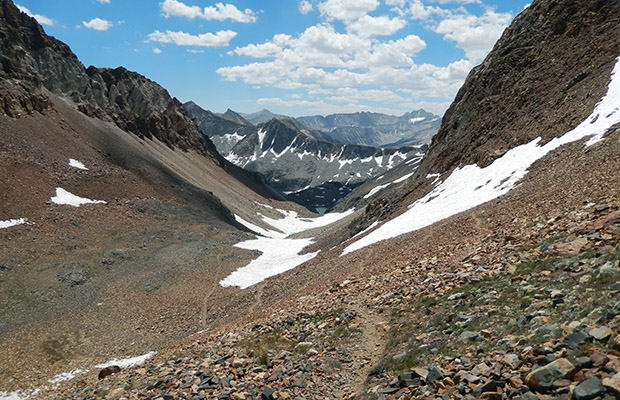
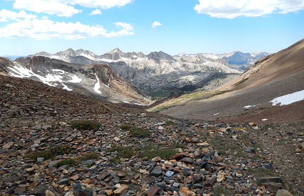
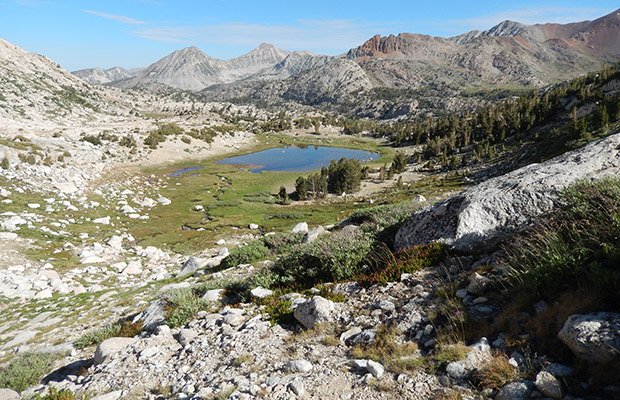
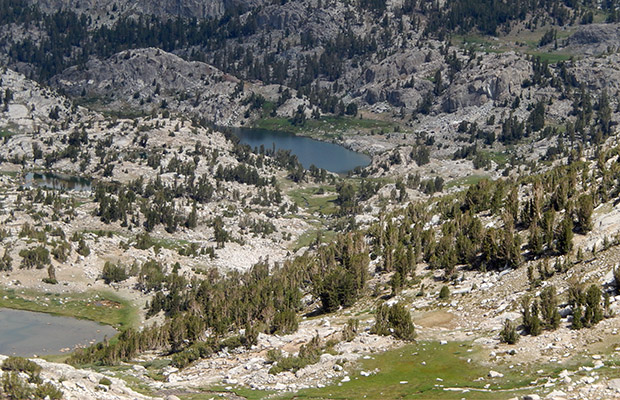
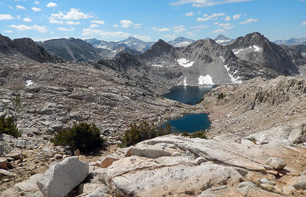
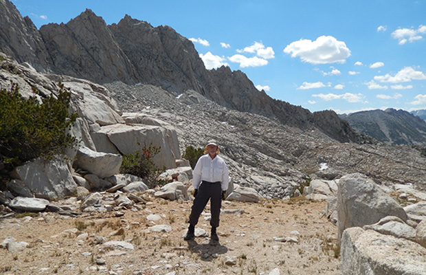
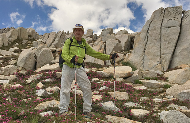
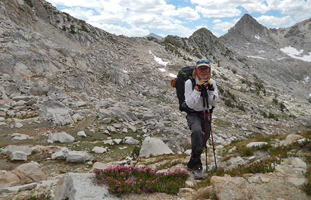
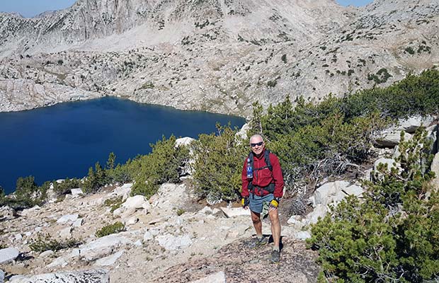
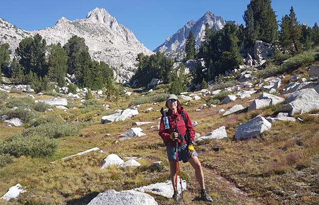
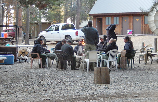
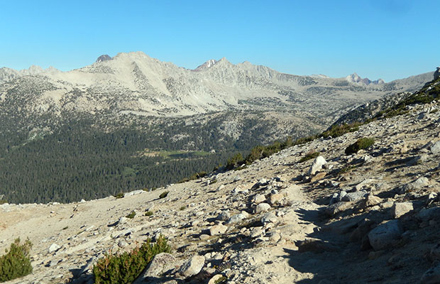
Steve Roper's Sierra High Route is no place for old men, but Bob Williams and I can't keep away from attempting sections of the Route each summer. Last year we completed the section from Lake Italy north to Mono Creek [Second Recess exit] and then from Mono Creek north to Bighorn Pass. We backtracked from there to Mono Creek and exited over Mono Pass to Mosquito Flat.

Our reason for not continuing on the Route from Bighorn Pass was twofold: No vehicle positioned at McGee Pass trailhead and the daunting appearance of the terrain lying between Bighorn and Shout of Relief Passes. However, by the time we returned to the Mono Creek drainage from Laurel Lake, we were confident of reusing this section, should we ever hike south from McGee Pass Trail over Shout of Relief Pass.

So that's exactly what we planned and executed [with style!] this year, exiting the McGee Pass Trail at Tully Lake with an easy climb up to the northern side of Shout of Relief Pass.


  • On the McGee Pass trail above Big McGee Lake On the McGee Pass trail above Big McGee Lake
  • Traversing the trail below McGee Pass, with a steep snow section ahead Traversing the trail below McGee Pass, with a steep snow section ahead
  • Off the trail to avoid the steep snow crossing without crampons and ice ax. Off the trail to avoid the steep snow crossing without crampons and ice ax.
  • A tough climb on loose moving talus with a heavy pack, but much safer than the snow crossing A tough climb on loose moving talus with a heavy pack, but much safer than the snow crossing
  • Looking back down the trail from the 12,000' McGee Pass Looking back down the trail from the 12,000' McGee Pass
  • The rare and beautiful "Sky Pilot" wildflowers on the summit of McGee Pass The rare and beautiful "Sky Pilot" wildflowers on the summit of McGee Pass
  • Looking west from the summit of McGee Pass and our route downhill to Tully Lake. Looking west from the summit of McGee Pass and our route downhill to Tully Lake.
  • The view from our Tully Lake campsite with Shout of Relief Pass on the low point of the skyline The view from our Tully Lake campsite with Shout of Relief Pass on the low point of the skyline
  • Early morning departure from Tully Lake, enroute to Shout of Relief Pass Early morning departure from Tully Lake, enroute to Shout of Relief Pass
  • The last lake/pond below Shout of Relief Pass The last lake/pond below Shout of Relief Pass
  • A telephoto look at Tully Lake from the summit of Shout of Relief Pass A telephoto look at Tully Lake from the summit of Shout of Relief Pass
  • Looking south from the summit of Shout of Relief Pass with Rosy Finch Lake below. Looking south from the summit of Shout of Relief Pass with Rosy Finch Lake below.
  • Bob on the distinctly flat summit of Shout of Relief Pass Bob on the distinctly flat summit of Shout of Relief Pass
  • The last big .. and steep descent before climbing back up to Bighorn Pass The last big .. and steep descent before climbing back up to Bighorn Pass
  • The last big .. and steep descent before climbing back up to Bighorn Pass The last big .. and steep descent before climbing back up to Bighorn Pass
  • Bob on the last, almost flat section before climbing Bighorn Pass Bob on the last, almost flat section before climbing Bighorn Pass
  • Bighorn Pass is somewhere on that rocky ridge? Bighorn Pass is somewhere on that rocky ridge?
  • Bob just below the Bighorn Pass crossing with Rosy Finch Lake below Bob just below the Bighorn Pass crossing with Rosy Finch Lake below
{image.index} / {image.total}


  • Looking down at Laurel Lake from the eastern side of Bighorn Pass Looking down at Laurel Lake from the eastern side of Bighorn Pass
  • Our beautiful, but buggie camp, at Laurel Lake Our beautiful, but buggie camp, at Laurel Lake
  • Looking north across Laurel Lake to "Red and White Mountain" [12,800'] Looking north across Laurel Lake to "Red and White Mountain" [12,800']
  • A side trip to Grinnell Lake at 10,800' A side trip to Grinnell Lake at 10,800'
  • Bob on the High Route between Laurel Lake and Mono Creek Bob on the High Route between Laurel Lake and Mono Creek
  • A relaxing ride across Edison Lake to VVR from the JMT A relaxing ride across Edison Lake to VVR from the JMT
  • A relaxing ride across Edison Lake to VVR from the JMT A relaxing ride across Edison Lake to VVR from the JMT
  • The hiker campground at VVR The hiker campground at VVR
  • A group of forest firefighters relaxing at VVR. Dealing with fire near Devils Bathtub A group of forest firefighters relaxing at VVR. Dealing with fire near Devils Bathtub
  • Edison Lake in the early morning, waiting for our ride back to the JMT from VVR Edison Lake in the early morning, waiting for our ride back to the JMT from VVR
  • The Edison Ferry pickup point at the eastern end of the Lake [near the JMT] The Edison Ferry pickup point at the eastern end of the Lake [near the JMT]
  • The Edison Ferry pickup point at the eastern end of the Lake [near the JMT] The Edison Ferry pickup point at the eastern end of the Lake [near the JMT]
  • An old favorite campsite at Trail Lakes [11,200'] An old favorite campsite at Trail Lakes [11,200']
  • A shave at 11,200' before meeting our adoring sycophants the next day A shave at 11,200' before meeting our adoring sycophants the next day
  • The Mono Pass trail above our Trail Lakes campsite The Mono Pass trail above our Trail Lakes campsite
  • On the Mono Pass trail looking back down into Pioneer Basin On the Mono Pass trail looking back down into Pioneer Basin
  • Bob on the rocks of Summit Lake with Mono Pass [12,000'] in the background Bob on the rocks of Summit Lake with Mono Pass [12,000'] in the background
  • Peter resting at the top of descent from Mono Pass to Mosquito Flat ... and home! Peter resting at the top of descent from Mono Pass to Mosquito Flat ... and home!
{image.index} / {image.total}

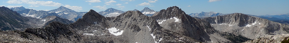
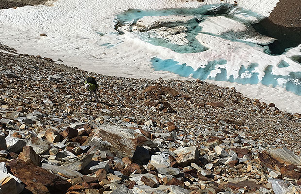
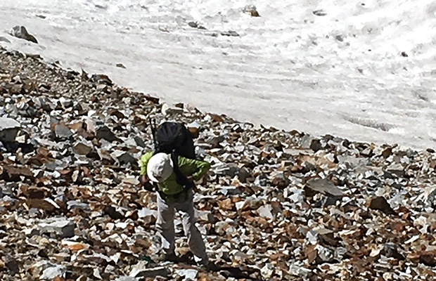
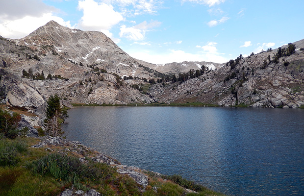
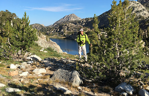
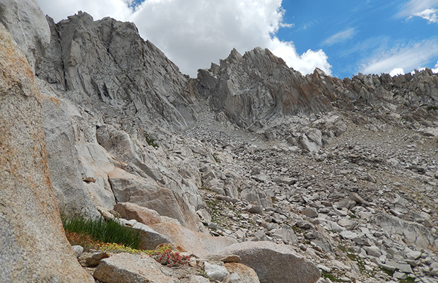
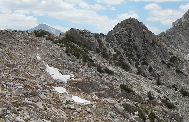
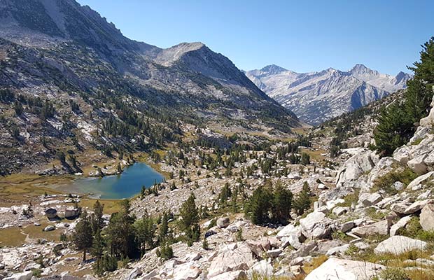
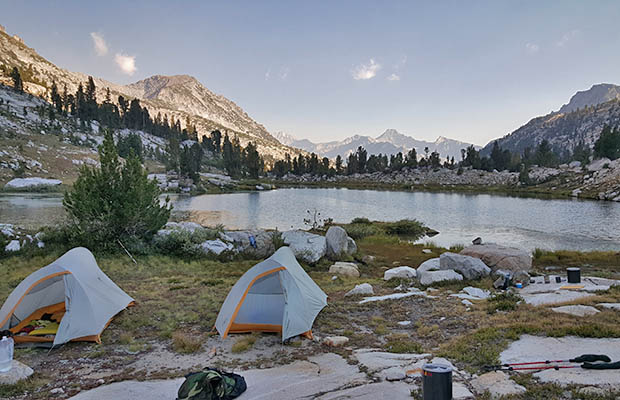
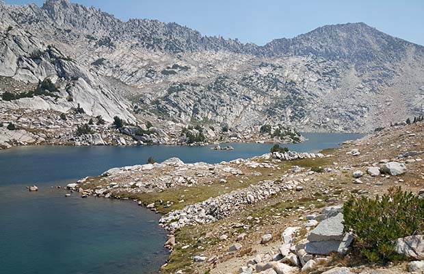
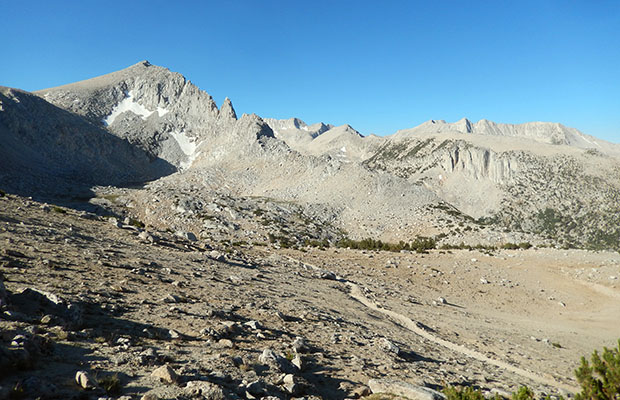
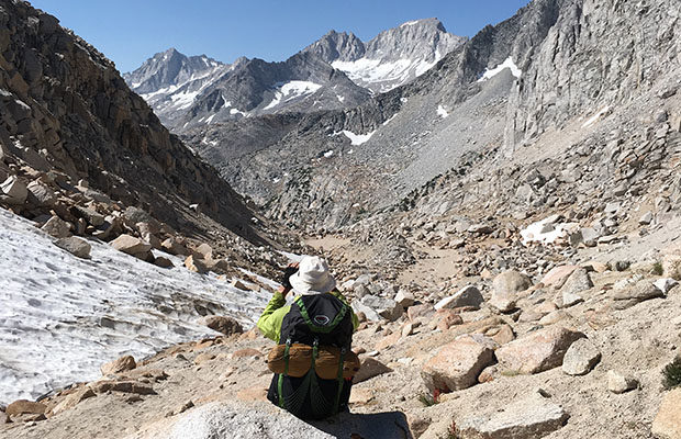
Once on the Pass, the view across the convoluted rock slabs, talus and steep cliffs to Bighorn Pass was even more daunting than last year. But luck was ours with the meeting of a young couple heading north. The young guy [experienced climber] had done the complete High Route a few years ago and pointed out the safest route across the jumbled terrain to reach Bighorn Pass.

Following the instructions, Bob and I had little problem getting safely to Bighorn Pass, but we did meet a couple of other hikers heading north who'd literally been hanging out on rock faces and other nasty stuff because they'd wandered off the best route.

From Bighorn Pass it was all downhill and known terrain for us, but still potentially hazardous until we reached last year's campsite beside Laurel Lake. A violent thunderstorm evening at the Lake, a good sleep and next morning an easy stroll down to Mono Creek Trail. We walked out over Mono Pass feeling much younger than 77/76 and super-elated at our achievement.

©2016 Peter Tremayne, Reno NV
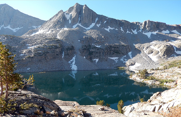
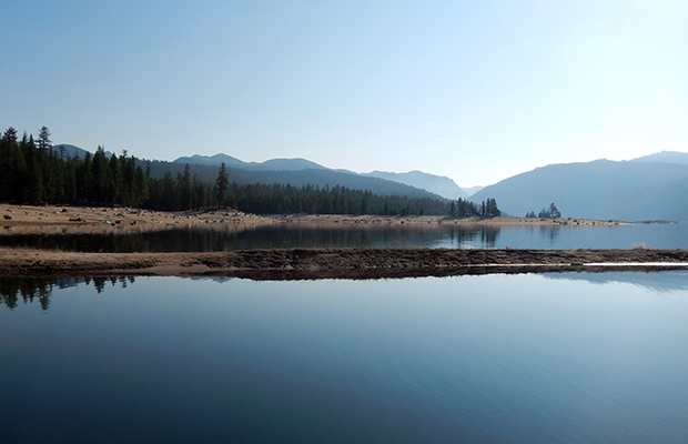
Back to Top


latest news2020 | latest news2019 | latest news2018 | latest news2017 | home | main players | contact us | sierra nevada | jmt access map | jmt planning | 2024equipment | jmt schedules | jmt2016 | jmt 2015 | jmt 2014 | jmt 2013 | jmt 2012 | jmt 2011 | jmt 2010 | jmt 2009 | jmt 2008 | jmt 2007 | jmt 2006 | jmt 2005 | jmt 2004 | jmt 2002 | mt agassiz | mt sill | mt shasta | matterhorn peak | mt egmont | nz 2016 | mt rainier | mt shuksan | mt jefferson | pct sonora nth | pct tm nth | pct wa nth | mt baker | wonder trail | mera peak | mt adams | goat rocks | cascades 2003 | mt whitney | kaibab trail | presidents | antarctica | hoover pct | recesses | highrte2015 | highrte2016 | denali89 | benson lake | videos mp4 | tremaynes |