
Matterhorn Peak Climb 2010
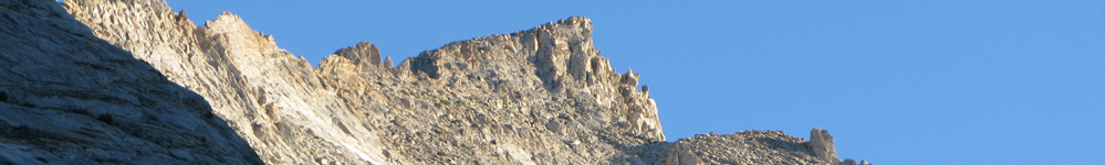
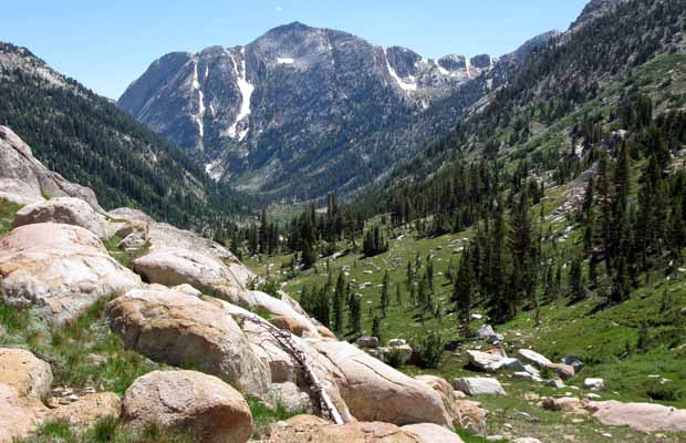
One week after returning from the Sonora Pass to Echo Lake PCT hike, I drove south again, this time to Lee Vining, to spend the night there and obtain a trail permit to hike from Virginia Lakes Resort to Burro Pass. This particular adventure had been on my books since June 2008 when I’d hiked north from Tuolumne Meadows and up Spiller Canyon to Horse Creek Pass. There, I’d camped below the southeast face of Matterhorn Peak (12,300’), but didn’t attempt a summit climb, despite the route looking very straightforward. This time, I planned to hike the extra distance, using the PCT to Matterhorn Canyon and then up the side trail to Burro Pass (unfortunately 22 miles each way), to climb the Class 2 route on the southwest face of Matterhorn Peak. I discarded the option of returning to Horse Creek Pass via Spiller Canyon: lesser distance, but all off trail hiking from the PCT crossing at Spiller Creek, with difficult and hazardous route finding … and into a very isolated location for a solo climbing guy like me. |
|
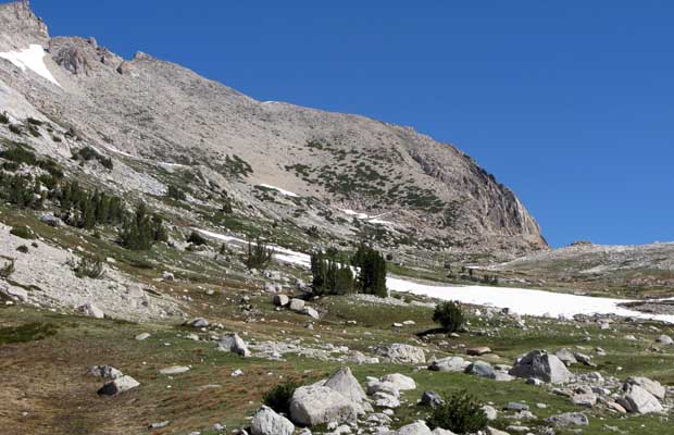
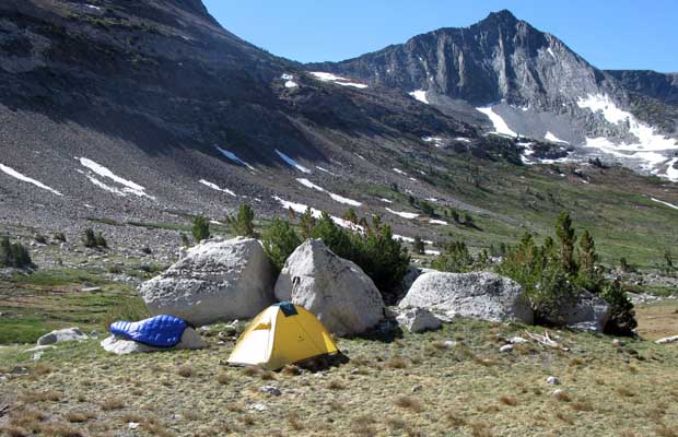
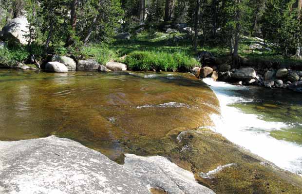
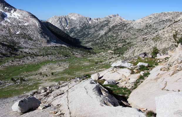
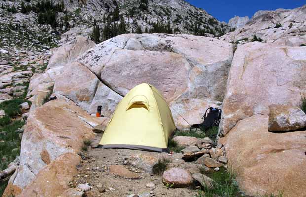
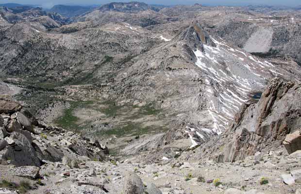
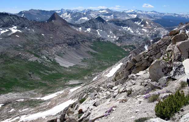
Setting off from Virginia lakes Resort with five days of food, I planned on two days hiking to the base of Matterhorn’s southwest slope, one day on the mountain and then returning to Virginia Lakes in two more days. My first camp was near the PCT crossing of Return Creek, the fast running creek that flows down the length of Virginia Canyon. I discovered an excellent site on the western side of the creek that didn’t require the difficult water crossing to the established campsites on the other side. Being quite sure I had the location to myself, I took advantage of the warm water and calm sunny environment to strip off and wash in the creek; using a small amount of biodegradable liquid soap. One hour later, after eating dinner and then going to the creek to brush my teeth, the most bizarre event occurred. Looking down the creek I saw a large number of people perched on big boulders, perfectly still, like stone gargoyles attached to the granite. On closer inspection, they all appeared to be young women, staring at me, either appraising or condemning me for washing in the stream … or some other breach of hiking ethics? I must admit I was shocked by their sudden appearance, their complete silence and in particular their strange positioning on creek boulders, like birds on a perch … or worse; a surreal tableau of demons waiting for me. This was an image that returned a few days later after descending from Matterhorn Peak. The closest ‘gargoyle’ to my location was squatting on a boulder in the middle of the creek … with dry feet! How did she get there? On a broom maybe. I walked down the creek bank to where it was possible to converse with her over the sound of the rushing water. I opened the conversation by asking where they were camping, because I was surprised to find them so far up from the established campsites on the eastern side of Return Creek. She explained that she was leading a group of fourteen young women on a hiking/backpacking trip from Tuolumne Meadows to Twin Lakes, and because of the group size, had found it necessary to spread out some distance along the creek bank. My guess was their visit up near my ‘isolated’ camp was for ablutionary purposes … and that my presence had interfered with that. Although not mentioned by the head gargoyle, I suspected at least one of them had seen me bathing in the creek and my crime was not immodesty, but rather using soap in the water! How I hate meeting these Trail Nazis … a good reason to practice stealth camping (which I thought I was doing at this place!) like an experienced PCT thru-hiker! Next morning I packed up early and hit the trail by 7:30, hoping to get well ahead of the women’s group that would also be heading north on the PCT. Ten minutes after leaving camp, I passed the crossing and saw the group over the creek, messing around, trying to get organized to get moving. I’d figured that such a large group of newbie’s would take forever to pack up in the mornings and not move fast along the trails. A gentle ascent to the Spiller Creek crossing and then the long hard climb to Miller Lake (beautiful location for camping), then the long steep descent into Matterhorn Canyon where I turned right onto the Burro Pass Trail. |
|
|
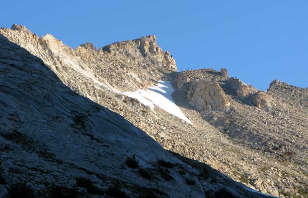
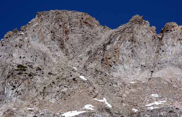
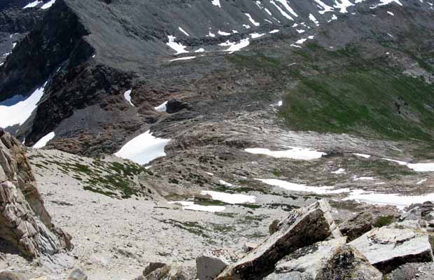
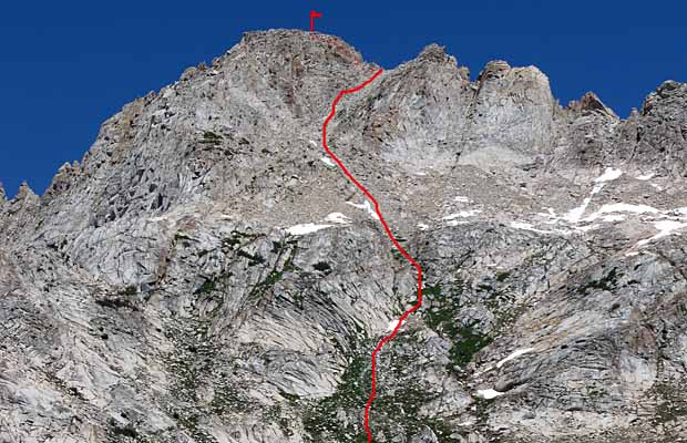
R.J. Secor’s The High Sierra describes the Southwest Side climb of Matterhorn Peak as Class 2, with the route guide: “Ascend the broad scree gully in the center of the southwest slope. This side of the peak is easily reached from Burro Pass.” That’s it! So my plan for the climbing day was to leave the camp in place and ascend the trail to Burro Pass, then climb the southwest slope. Big mistake! On arriving at the Pass, I was greeted by six guys who’d come up from the northern side, having backpacked in from Twin Lakes and spent last night camped by Piute Creek. Like me, they’d come to the Pass to climb Matterhorn Peak from the southwest slope, but were equally confused as to where the route began, despite one of them having done this many years before. After some discussion, we figured out that the route began from 600’ below the south side of the Pass … where I’d just climbed from! If I hadn’t been following Secor’s instructions to the letter, the direct route would’ve been very obvious; the route actually begins at the level base of a distinct cirque at the head of Matterhorn Canyon. Therefore hiking in from the south, as I had, there’s no need to climb the 600’ to Burro Pass … what a bummer! |
|---|
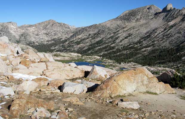
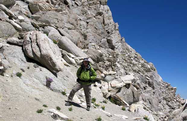
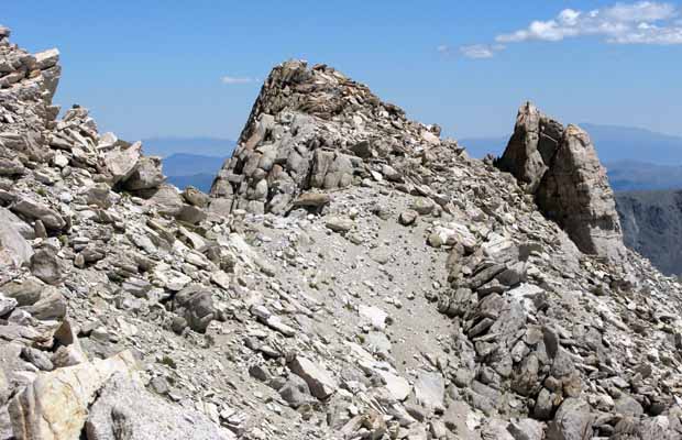
With about 300’ to reach the summit, I met the six on their way back down the slippery slope. They’d reached a small saddle about 100’ below the summit … and run out of ideas and bravado. One had found his way up onto the summit rocks, but said the experience had really spooked him. I didn’t find this revelation very encouraging for my own endeavor and just hoped that he’d missed the correct route. I reached the saddle which is quite flat, with vertical rock on the summit side, but dropping away to the east on a long scree slope down to Horse Creek Pass. This side of the mountain I was familiar with from my hike up Spiller Canyon back in 2008. It was obvious that the route from Horse Creek Pass would’ve been much easier and safer that what I‘d just experienced … and had to go back down in one piece! I believed that the route to the summit proper could be found on an eastern traverse below the vertical rock, to a point that had an obvious staircase formation. But I decided not to find out: My knees were already sore and the difficulty of the descent was uppermost on my mind … get down from here safely, and as soon as possible. It was not easy, and in places, downright dangerous with the pain and loss of flexibility in my knees. So I took my time, and twice had close calls; one with an extended slide on wet granite and the other after dislodging two large boulders … one of which I’d been using for a handhold to swing my legs across a deep crack through a slab. When they came loose, I let go of the lower boulder and moved my leg back from the fall line, both boulders barely missed hitting my right knee and foot. This could have been a nasty accident, high on the mountain, without any immediate help (the group of six had long time gone from the mountain). As it turned out, the fourteen gargoyles (or should I say gargirls!), had probably been watching my progress from afar … my yellow shirt would have been clearly visible from the trail up to Burro Pass. When I did thankfully reach the level area at the base of the climb, I spotted the party traversing up the trail, 500’ above me. I’d fortunately told their leader that I planned to climb Matterhorn Peak and it became evident they’d been following my progress during the tortuous descent down the slope. From high above, the team whooped and yelled as I strolled safely across the level ground. The rest of my trip out was uneventful. I was feeling much fitter, particularly on the first day from below Burro Pass to Return Creek, possibly because the only serious climb was out of Matterhorn Canyon up to Miller Lake. The remainder was all downhill and I had my knee pain under control, thanks to Advil. I camped at the same location by Return Creek … this time without gargoyles or any other campers nearby. On the final day, hiking up Virginia Canyon to Summit Lake I did have a “Dr Livingston I presume” moment. As I struggled up from the canyon to Summit Lake (on the nasty steep trail section that has few switchbacks!), I was passed by a day-hiker dressed in tennis whites, black socks, brogues and a pith helmet. Was he British … I don’t know, because he didn’t respond to my quip re Dr Livingston. Some people in the mountains just don’t have a sense of humor! |
|
|
This trip was the first time in many years that I’d gone into the Sierras solo, for the specific purpose to climb a peak. It would have been much quicker and easier with a strong partner; we’d have taken the cross-country route from Twin Lakes up the horse Creek Trail to Horse Creek Pass, camped there at the head of Spiller Canyon and climbed Matterhorn Peak on the straightforward southeast slope … 15 miles round trip max. On being solo, I wasn’t prepared to handle the steep talus below Horse Creek Pass with my wobbly knees, but in retrospect it probably wouldn’t have been any worse than what I experienced going up the southwest slope … and with 22 miles backpacking each way. Another choice would have been to approach the southwest slope from Twin Lakes, which is what the group of six climbers that I met on Burro Pass had done. This route is 15 miles each way and could be done, including the climb, in three days. I can’t remember my reasoning for not making this choice, but perhaps it had to do with my familiarity with Virginia Canyon and the PCT in this area? Whatever, it was a good shakedown and fitness training for my annual JMT hike, due to begin on August 10th, 9 days hence. ©Peter Tremayne, Reno 2010 |
Return to Top
latest news2020 | latest news2019 | latest news2018 | latest news2017 | home | main players | contact us | sierra nevada | jmt access map | jmt planning | 2024equipment | jmt schedules | jmt2016 | jmt 2015 | jmt 2014 | jmt 2013 | jmt 2012 | jmt 2011 | jmt 2010 | jmt 2009 | jmt 2008 | jmt 2007 | jmt 2006 | jmt 2005 | jmt 2004 | jmt 2002 | mt agassiz | mt sill | mt shasta | matterhorn peak | mt egmont | nz 2016 | mt rainier | mt shuksan | mt jefferson | pct sonora nth | pct tm nth | pct wa nth | mt baker | wonder trail | mera peak | mt adams | goat rocks | cascades 2003 | mt whitney | kaibab trail | presidents | antarctica | hoover pct | recesses | highrte2015 | highrte2016 | denali89 | benson lake | videos mp4 | tremaynes |